Melgerðismelar - Melgerdismelar
Airport details
| Country | Iceland |
| State | Northeastern Region |
| Region | BI |
| Airspace | Reykjavik Ctr |
| Municipality | Eyjafjarðarsveit |
| Elevation | 88ft (27m) |
| Timezone | GMT +0 |
| Coordinates | 65.48333, -18.16667 |
| Magnetic var | |
| Type | land |
| Available since | X-Plane v10.40 |
| ICAO code | BIMM |
| IATA code | n/a |
| FAA code | n/a |
Communication
| Melgerdismelar AFIS | 118.200 |
| Melgerdismelar CTAF | 119.900 |
Runway info
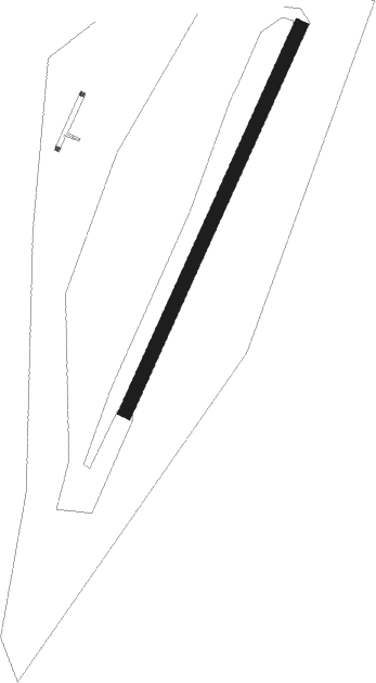
| Runway 04 / 22 | ||
| length | 672m (2205ft) | |
| bearing | 53° / 233° | |
| width | 22m (72ft) | |
| surface | gravel | |
Nearby beacons
| code | identifier | dist | bearing | frequency |
|---|---|---|---|---|
| TO | TORFUR (AKUREYRI) NDB | 1 | 43° | 324 |
| KN | KRISTNES (AKUREYRI) NDB | 6.7 | 46° | 364 |
| MOB | MOB TACAN | 9.4 | 33° | 114.80 |
| NB | BOTN (AKUREYRI) NDB | 9.9 | 219° | 387 |
| OE | ODDEYRI (AKUREYRI) NDB | 12.3 | 24° | 415 |
| AR | AKUREYRI NDB | 16.4 | 16° | 334 |
| AKI | AKUREYRI VOR/DME | 17 | 30° | 113.60 |
| HJ | HJALTEYRI (AKUREYRI) NDB | 22.1 | 356° | 319 |
| GA | GARDUR (HUSAVIK) NDB | 29.3 | 61° | 377 |
| HS | HUSAVIK NDB | 32.1 | 59° | 329 |
Disclaimer
The information on this website is not for real aviation. Use this data with the X-Plane flight simulator only! Data taken with kind consent from X-Plane 12 source code and data files. Content is subject to change without notice.