Reykjavik
Airport details
| Country | Iceland |
| State | Capital Region |
| Region | BI |
| Airspace | Reykjavik Ctr |
| Municipality | Reykjavik |
| Elevation | 43ft (13m) |
| Timezone | GMT +0 |
| Coordinates | 64.13000, -21.94056 |
| Magnetic var | |
| Type | land |
| Available since | X-Plane v10.40 |
| ICAO code | BIRK |
| IATA code | RKV |
| FAA code | n/a |
Communication
| Reykjavik ATIS | 128.100 |
| Reykjavik Ground Control | 121.700 |
| Reykjavik Tower | 118.000 |
| Reykjavik Approach | 119.000 |
| Reykjavik Departure | 119.000 |
Approach frequencies
| LOC | RW13 | 109.1 | 18.00mi |
| ILS-cat-I | RW19 | 109.9 | 18.00mi |
| 3.5° GS | RW19 | 109.9 | 18.00mi |
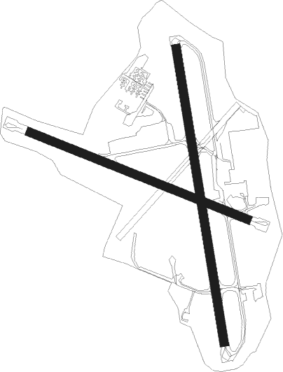
Runway info
Runway 01 / 19  | ||
| length | 1561m (5121ft) | |
| bearing | 349° / 169° | |
| width | 45m (148ft) | |
| surface | asphalt | |
| displ threshold | 82m (269ft) / 0m (0ft) | |
| Runway 13 / 31 | ||
| length | 1225m (4019ft) | |
| bearing | 102° / 282° | |
| width | 45m (148ft) | |
| surface | asphalt | |
| displ threshold | 0m (0ft) / 65m (213ft) | |
Nearby beacons
| code | identifier | dist | bearing | frequency |
|---|---|---|---|---|
| RK | REYKJAVIK NDB | 2.6 | 284° | 355 |
| EL | ELLIDAVATN NDB | 5.3 | 106° | 335 |
| KFV | KEFLAVIK VORTAC | 19.8 | 258° | 112.80 |
| KF | KEFLAVIK NDB | 22.5 | 260° | 392 |
| SE | SELFOSS NDB | 26.7 | 103° | 397 |
| RH | REYKHOLT NDB | 36.2 | 51° | 325 |
Departure and arrival routes
| Transition altitude | 7000ft |
| SID end points | distance | outbound heading | |
|---|---|---|---|
| RW01 | |||
| EL1 | 28mi | 81° | |
| KFV1 | 20mi | 258° | |
| MYRAR1 | 35mi | 340° | |
| RW13 | |||
| EL4 | 28mi | 81° | |
| KFV4 | 20mi | 258° | |
| MYRAR4 | 35mi | 340° | |
| RW19 | |||
| EL2 | 28mi | 81° | |
| KFV2 | 20mi | 258° | |
| MYRAR2 | 35mi | 340° | |
| RW31 | |||
| EL3 | 28mi | 81° | |
| KFV3 | 20mi | 258° | |
| MYRAR3 | 35mi | 340° | |
| STAR starting points | distance | inbound heading | |
|---|---|---|---|
| RW19 | |||
| INGA2N | 71.1 | 100° | |
| MYRA1N | 34.7 | 160° | |
| TERT2N | 19.0 | 215° | |
| TIBR1N | 28.1 | 261° | |
| NASB1V | 43.2 | 277° | |
Instrument approach procedures
| runway | airway (heading) | route (dist, bearing) |
|---|---|---|
| RW01 | BABTU (349°) | BABTU 3300ft RKI01 (5mi, 349°) 3100ft |
| RW01 | KERIR (305°) | KERIR 5100ft RKI01 (6mi, 268°) 3100ft |
| RW01 | NEXEM (43°) | NEXEM 4000ft RKI01 (6mi, 88°) 3100ft |
| RNAV | RKI01 3100ft RKF01 (5mi, 349°) 2400ft 20THR (4mi, 349°) 820ft BIRK (2mi, 345°) 73ft RKT01 (7mi, 351°) ALTUS (12mi, 284°) 3000ft ALTUS (turn) 3000ft | |
| RW13 | ELNIG (90°) | ELNIG 3600ft INGOX (5mi, 48°) 2400ft |
| RW13 | NARMO (102°) | NARMO 3100ft INGOX (4mi, 102°) 2400ft |
| RW13 | TABIT (123°) | TABIT 4700ft INGOX (6mi, 228°) 2400ft |
| RNAV | INGOX 2400ft RKF13 (5mi, 102°) 1700ft BIRK (5mi, 102°) 71ft RKT13 (4mi, 102°) INGOX (15mi, 282°) 2400ft | |
| RW19 | KUSUR (219°) | KUSUR 5100ft EXINU (5mi, 268°) 3600ft |
| RW19 | LUSUG (170°) | LUSUG 5100ft EXINU (5mi, 169°) 3600ft |
| RW19 | MIKVU (129°) | MIKVU 3600ft EXINU (5mi, 88°) 3600ft |
| RNAV | EXINU 3600ft RKF19 (5mi, 169°) 2700ft BIRK (8mi, 170°) 79ft (3971mi, 161°) 1000ft (turn) 3600ft | |
| RWNVA | DIZMA (272°) | DIZMA 5100ft RK31I (5mi, 248°) 3500ft |
| RWNVA | EGGUR (282°) | EGGUR 5100ft RK31I (5mi, 282°) 3500ft |
| RWNVA | FUZZO (296°) | FUZZO 3500ft RK31I (5mi, 15°) 3500ft |
| RNAV | RK31I 3500ft RK31F (5mi, 282°) 2700ft BIRK (6mi, 282°) 88ft INGOX (10mi, 282°) ALTUS (8mi, 336°) ALTUS (turn) 3000ft |
Disclaimer
The information on this website is not for real aviation. Use this data with the X-Plane flight simulator only! Data taken with kind consent from X-Plane 12 source code and data files. Content is subject to change without notice.