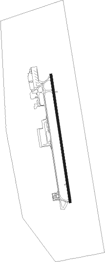
Prishtina - Pristina Intl
Airport details
| Country | Kosovo |
| State | Pristina District |
| Region | BK |
| Municipality | Vrellë e Goleshit |
| Elevation | 1789ft (545m) |
| Timezone | GMT +1 |
| Coordinates | 42.58674, 21.02954 |
| Magnetic var | |
| Type | land |
| Available since | X-Plane v10.40 |
| ICAO code | BKPR |
| IATA code | PRN |
| FAA code | n/a |
Communication
| Pristina Intl ATIS | 132.000 |
| Pristina Intl Ground Control | 118.000 |
| Pristina Intl Tower | 120.125 |
| Pristina Intl Approach | 118.775 |
Approach frequencies
| ILS-cat-III | RW17 | 110.1 | 18.00mi |
| 3° GS | RW17 | 110.1 | 18.00mi |
Nearby beacons
| code | identifier | dist | bearing | frequency |
|---|---|---|---|---|
| PRT | PRISTINA VOR/DME | 1.9 | 169° | 111.05 |
| BUI | BUDISAVCI VOR/DME | 23.7 | 275° | 115.20 |
| BLC | BLACE NDB | 42.2 | 27° | 377 |
| BLC | BLACE VOR/DME | 42.3 | 27° | 116.10 |
| ZO | NIS NDB | 47.1 | 49° | 423 |
| SKJ | SKOPJE VOR/DME | 47.3 | 137° | 112.80 |
| PT | SKOPJE INTL NDB | 48.6 | 138° | 295 |
| NS | NIS NDB | 55.4 | 48° | 255 |
| JST | NIS NDB | 56.8 | 36° | 405 |
| NII | NIS VOR/DME | 57.7 | 48° | 113.90 |
Departure and arrival routes
| Transition altitude | 10000ft |
| SID end points | distance | outbound heading | |
|---|---|---|---|
| RW17 | |||
| UDVA1C, UDVA1B | 32mi | 1° | |
| SARA1C, SARA1B | 30mi | 195° | |
| KUKA1C, KUKA1B | 40mi | 255° | |
| DOLE1C, DOLE1B | 35mi | 289° | |
| RW35 | |||
| UDVA1E, UDVA1F | 32mi | 1° | |
| SARA1E, SARA1F | 30mi | 195° | |
| KUKA1F, KUKA1E | 40mi | 255° | |
| DOLE1F, DOLE1E | 35mi | 289° | |
| STAR starting points | distance | inbound heading | |
|---|---|---|---|
| RW17 | |||
| ARBE1C | 36.1 | 49° | |
| MEDU1B, MEDU1C | 45.5 | 99° | |
| REDV1B, REDV1C | 32.2 | 134° | |
| XAXA1C | 30.0 | 327° | |
| RW35 | |||
| ARBE1F | 36.1 | 49° | |
| MEDU1F, MEDU1E | 45.5 | 99° | |
| REDV1F | 32.2 | 134° | |
| XAXA1F | 30.0 | 327° | |
Holding patterns
| STAR name | hold at | type | turn | heading* | altitude | leg | speed limit |
|---|---|---|---|---|---|---|---|
| ARBE1C | PRT | NDB | left | 323 (143)° | > 6200ft | 1.0min timed | 230 |
| ARBE1F | PRT | NDB | left | 323 (143)° | > 6200ft | 1.0min timed | 230 |
| MEDU1C | PRT | NDB | left | 323 (143)° | > 6200ft | 1.0min timed | 230 |
| MEDU1E | PRT | NDB | left | 323 (143)° | > 6200ft | 1.0min timed | 230 |
| MEDU1F | PRT | NDB | left | 323 (143)° | > 6200ft | 1.0min timed | 230 |
| REDV1C | PRT | NDB | left | 323 (143)° | > 6200ft | 1.0min timed | 230 |
| REDV1F | PRT | NDB | left | 323 (143)° | > 6200ft | 1.0min timed | 230 |
| XAXA1C | PRT | NDB | left | 323 (143)° | > 6200ft | 1.0min timed | 230 |
| *) magnetic outbound (inbound) holding course | |||||||
Disclaimer
The information on this website is not for real aviation. Use this data with the X-Plane flight simulator only! Data taken with kind consent from X-Plane 12 source code and data files. Content is subject to change without notice.
