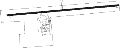
Nappanee - Nappanee Muni
Airport details
| Country | United States of America |
| State | Indiana |
| Region | K5 |
| Airspace | Chicago Ctr |
| Municipality | Nappanee |
| Elevation | 858ft (262m) |
| Timezone | GMT -5 |
| Coordinates | 41.44616, -85.93605 |
| Magnetic var | |
| Type | land |
| Available since | X-Plane v10.40 |
| ICAO code | C03 |
| IATA code | n/a |
| FAA code | n/a |
Communication
| Nappanee Muni CTAF/UNICOM | 122.800 |
| Nappanee Muni SOUTH BEND Approach/Departure | 132.050 |
Nearby Points of Interest:
Nappanee Eastside Historic District
-Frank and Katharine Coppes House
-Arthur Miller House
-Stahly-Nissley-Kuhns Farm
-Butler Community Mausoleum
-Hall Farm (Clunette, Indiana)
-William N. Violett House
-Leesburg Historic District
-Violett-Martin House and Gardens
-St. John's Lutheran Church
-Dierdorff Farmstead
-Downtown Nappanee Historic District
-Goshen Historic District
-Dietrich-Bowen House
-Goshen Carnegie Public Library
-Bremen Water Tower
-Elkhart County Courthouse
-John Pound Store
-Joseph and Sarah Puterbaugh Farm
-Bourbon Community Building-Gymnasium
-East Fort Wayne Street Historic District
-Warsaw Courthouse Square Historic District
-Erwin House
-Justin Zimmer House
-Morehous Residential Historic District
Nearby beacons
| code | identifier | dist | bearing | frequency |
|---|---|---|---|---|
| GSH | GOSHEN VORTAC | 6.2 | 311° | 113.70 |
| SB | MISHA (SOUTH BEND) NDB | 20.1 | 313° | 341 |
| OLK | WEBSTER LAKE VOR | 23.1 | 114° | 110.40 |
| GIJ | GIPPER (NILES) VORTAC | 25.8 | 310° | 115.40 |
| IRS | STURGIS NDB | 31.5 | 54° | 382 |
| OXI | KNOX VOR/DME | 32.9 | 260° | 115.60 |
| VP | SEDLY (VALPARAISO) NDB | 42.3 | 270° | 212 |
| ELX | KEELER VOR/DME | 42.7 | 345° | 116.60 |
| FWA | FORT WAYNE VORTAC | 43.9 | 122° | 117.80 |
| AZ | AUSTN (KALAMAZOO) NDB | 44.9 | 31° | 371 |
| GW | SHENK (AUBURN) NDB | 45.4 | 98° | 227 |
| GUS | GRISSOM (PERU) VORTAC | 49.1 | 195° | 108.45 |
| AZO | KALAMAZOO VOR/DME | 50.4 | 26° | 109 |
| OKK | KOKOMO VORTAC | 55.4 | 188° | 113.50 |
| MZZ | MARION VOR/DME | 58.3 | 165° | 108.60 |
| BT | BATOL (BATTLE CREEK) NDB | 64.4 | 39° | 272 |
Disclaimer
The information on this website is not for real aviation. Use this data with the X-Plane flight simulator only! Data taken with kind consent from X-Plane 12 source code and data files. Content is subject to change without notice.