Hart - Oceana Co
Airport details
| Country | United States of America |
| State | Michigan |
| Region | K5 |
| Airspace | Chicago Ctr |
| Municipality | Shelby Township |
| Elevation | 910ft (277m) |
| Timezone | GMT -5 |
| Coordinates | 43.64164, -86.32906 |
| Magnetic var | |
| Type | land |
| Available since | X-Plane v10.40 |
| ICAO code | C04 |
| IATA code | n/a |
| FAA code | C04 |
Communication
| OCEANA CO CTAF | 122.700 |
Nearby Points of Interest:
Hart Downtown Historic District
-Jared H. Gay House
-Navigation Structures at Pentwater Harbor
-Pentwater South Pierhead Light
-Dumaw Creek Site
-Mason County Courthouse
-Warren A. and Catherine Cartier House
-Ludington United States Coast Guard Station
-Fremont High School
-Muskegon YMCA Building
-Central Fire Station
-Union Depot
-Muskegon Historic District
-Hume House
-Charles H. Hackley House
-Marlborough Historic District
-Idlewild
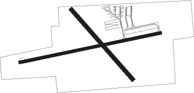
Runway info
Runway 9 / 27  | ||
| length | 1064m (3491ft) | |
| bearing | 85° / 265° | |
| width | 23m (75ft) | |
| surface | asphalt | |
| Runway 15 / 33 | ||
| length | 686m (2251ft) | |
| bearing | 134° / 314° | |
| width | 30m (100ft) | |
| surface | grass | |
| displ threshold | 113m (371ft) / 170m (558ft) | |
Nearby beacons
| code | identifier | dist | bearing | frequency |
|---|---|---|---|---|
| HIC | WHITE CLOUD VOR/DME | 26.9 | 96° | 117.60 |
| MKG | MUSKEGON TACAN | 31 | 148° | 115.20 |
| MBL | DME | 37.9 | 7° | 111.40 |
| MB | JEPOT (MANISTEE) NDB | 38.6 | 16° | 254 |
| MA | WEXOR (CADILLAC) NDB | 49.2 | 53° | 336 |
| GR | KNOBS (GRAND RAPIDS) NDB | 61.1 | 128° | 263 |
| VIO | VICTORY VOR/DME | 62.9 | 136° | 115.95 |
Instrument approach procedures
| runway | airway (heading) | route (dist, bearing) |
|---|---|---|
| RW09 | FOGAT (85°) | FOGAT 3300ft |
| RNAV | FOGAT 3300ft HOMUT (5mi, 85°) 2500ft ENEXE (3mi, 85°) 1500ft C04 (2mi, 85°) 956ft (5246mi, 117°) 1316ft WHALL (5243mi, 297°) 3300ft WHALL (turn) | |
| RW27 | AREAL (265°) | AREAL 3300ft |
| RNAV | AREAL 3300ft DOOZY (5mi, 265°) 2500ft HODAT (3mi, 265°) 1600ft C04 (2mi, 265°) 942ft (5246mi, 117°) 1500ft WHALL (5243mi, 297°) 3300ft WHALL (turn) |
Disclaimer
The information on this website is not for real aviation. Use this data with the X-Plane flight simulator only! Data taken with kind consent from X-Plane 12 source code and data files. Content is subject to change without notice.