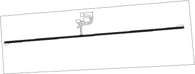
Brooklyn - Skydive Iowa
Airport details
| Country | United States of America |
| State | Iowa |
| Region | |
| Airspace | Chicago Ctr |
| Municipality | Poweshiek County |
| Elevation | 818ft (249m) |
| Timezone | GMT -6 |
| Coordinates | 41.74542, -92.41209 |
| Magnetic var | |
| Type | land |
| Available since | X-Plane v10.40 |
| ICAO code | C12 |
| IATA code | n/a |
| FAA code | 091A |
Communication
Nearby Points of Interest:
Chambers Ford Bridge
-Frank E. and Katie (Cherveny) Zalesky House
-Poweshiek County Courthouse
-Montezuma Downtown Historic District
-Belle Plaine Main Street Historic District
-Sankot Motor Company
-E.A. and Rebecca (Johnson) Marsh House
-Mears Cottage
-Chicago, Rock Island and Pacific Railroad-Grinnell Passenger Station
-Goodnow Hall
-Levi P. Grinnell House
-Stewart Library
-B.J. Ricker House
-Interior Telephone Company Building
-Farmers Mutual Reinsurance Company Building
-Bowers and McDonald Office Building
-Grinnell Herald Building
-Pioneer Oil Company Filling Station
-Spaulding Manufacturing Company
-Christian Science Society
-Lincoln Highway Bridge
-Iowa County Courthouse
-Tama County Courthouse
-Tama County Jail
-Overland Waterloo Company Building
Nearby beacons
| code | identifier | dist | bearing | frequency |
|---|---|---|---|---|
| CID | CEDAR RAPIDS VOR/DME | 29.3 | 77° | 114.10 |
| JWJ | ELMWOOD (MARSHALTOWN) VOR/DME | 31.2 | 306° | 109.40 |
| TNU | NEWTON VOR/DME | 31.3 | 273° | 112.50 |
| PEA | PELLA NDB | 31.4 | 237° | 257 |
| IOW | IOWA CITY VOR/DME | 38.3 | 106° | 116.20 |
| OTM | OTTUMWA VOR/DME | 43.1 | 173° | 111.60 |
| IIB | WAPSIE (INDEPENDENCE) NDB | 47.2 | 33° | 206 |
| ALO | WATERLOO VOR/DME | 48.7 | 1° | 112.20 |
Disclaimer
The information on this website is not for real aviation. Use this data with the X-Plane flight simulator only! Data taken with kind consent from X-Plane 12 source code and data files. Content is subject to change without notice.
