South Pekin - Pekin Muni
Airport details
| Country | United States of America |
| State | Illinois |
| Region | K5 |
| Airspace | Chicago Ctr |
| Municipality | Tazewell County |
| Elevation | 528ft (161m) |
| Timezone | GMT -6 |
| Coordinates | 40.48819, -89.67589 |
| Magnetic var | |
| Type | land |
| Available since | X-Plane v10.40 |
| ICAO code | C15 |
| IATA code | n/a |
| FAA code | n/a |
Communication
| Pekin Muni CTAF/UNICOM | 122.800 |
| Pekin Muni PEORIA Approach/Departure | 124.675 |
Nearby Points of Interest:
Carl Herget Mansion
-Pekin Federal Building
-Tazewell County Courthouse
-Waltmire Bridge
-Ayer Public Library
-Peoria State Hospital
-Lincoln Branch Peoria Public Library
-International Harvester Building
-John C. Proctor Recreation Center
-West Bluff Historic District
-Pettingill-Morron House
-Cumberland Presbyterian Church
-Central National Bank Building
-Peoria City Hall
-Peoria Mineral Springs
-Grand Army of the Republic Memorial Hall
-Peoria Federal Building and U.S. Courthouse
-Marquette Apartments
-YWCA Building
-Kickapoo Building
-Judge Jacob Gale House
-Allentown Union Hall
-North Side Historic District
-John C. Flanagan House Museum
-Pleasant Grove School
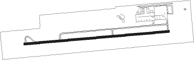
Runway info
| Runway 9 / 27 | ||
| length | 1521m (4990ft) | |
| bearing | 90° / 270° | |
| width | 23m (75ft) | |
| surface | asphalt | |
Nearby beacons
| code | identifier | dist | bearing | frequency |
|---|---|---|---|---|
| PI | TUNGG (PEORIA) NDB | 7.9 | 35° | 356 |
| PIA | PEORIA VORTAC | 12.6 | 329° | 115.20 |
| AAA | ABRAHAM (LINCOLN) NDB | 25 | 134° | 329 |
| BMI | BLOOMINGTON VOR/DME | 34 | 91° | 108.20 |
| LQ | LICOL (SPRINGFIELD) NDB | 34.7 | 173° | 375 |
| LH | EGROW (BLOOMINGTON-NORMAL) NDB | 36.8 | 85° | 334 |
| SPI | SPINNER (SPRINGFIELD) VORTAC | 38.9 | 180° | 112.70 |
| JZY | MACOMB NDB | 40.4 | 272° | 251 |
| BDF | BRADFORD VORTAC | 40.5 | 7° | 114.70 |
| CJ | CALDE (SPRINGFIELD) NDB | 41.8 | 173° | 240 |
| SP | HUSKK (SPRINGFIELD) NDB | 43.1 | 187° | 382 |
| GBG | DME | 43.8 | 301° | 109.80 |
| PNT | PONTIAC VOR/DME | 47.3 | 71° | 109.60 |
| IJX | DME | 49.9 | 218° | 108.60 |
| DE | ELWIN (DECATUR) NDB | 53.4 | 134° | 275 |
| AXC | ADDERS VORTAC | 58.7 | 132° | 117.20 |
| MZV | MOLINE VOR/DME | 66.4 | 311° | 114.40 |
Instrument approach procedures
| runway | airway (heading) | route (dist, bearing) |
|---|---|---|
| RW09 | LOGOS (113°) | LOGOS TICUY (14mi, 117°) 2500ft JUKAX (5mi, 179°) 2500ft |
| RW09 | LOTTO (19°) | LOTTO JUKAX (14mi, 315°) 2500ft JUKAX (turn) 2500ft |
| RW09 | PIA (149°) | PIA TICUY (9mi, 231°) 2500ft JUKAX (5mi, 179°) 2500ft |
| RNAV | JUKAX 2500ft HIMLO (6mi, 90°) 2200ft TUYOV (2mi, 90°) 1660ft C15 (4mi, 90°) 575ft (5390mi, 114°) 862ft WURID (5375mi, 294°) 2500ft WURID (turn) | |
| RW27 | MAROC (230°) | MAROC WURID (15mi, 172°) 2500ft |
| RW27 | NINIC (277°) | NINIC WURID (7mi, 293°) 2500ft |
| RW27 | WURID (270°) | WURID 2500ft |
| RNAV | WURID 2500ft POTIY (10mi, 270°) 2200ft USOCI (2mi, 270°) 1660ft C15 (4mi, 270°) 570ft (5390mi, 114°) 864ft JUKAX (5402mi, 294°) 2500ft JUKAX (turn) |
Disclaimer
The information on this website is not for real aviation. Use this data with the X-Plane flight simulator only! Data taken with kind consent from X-Plane 12 source code and data files. Content is subject to change without notice.