Berrien Springs - Andrews University Airpark
Airport details
| Country | United States of America |
| State | Michigan |
| Region | K5 |
| Airspace | Chicago Ctr |
| Municipality | Oronoko Charter Township |
| Elevation | 671ft (205m) |
| Timezone | GMT -5 |
| Coordinates | 41.95106, -86.36808 |
| Magnetic var | |
| Type | land |
| Available since | X-Plane v10.32 |
| ICAO code | C20 |
| IATA code | n/a |
| FAA code | C20 |
Communication
| Andrews University Airpark CTAF/UNICOM | 122.700 |
| Andrews University Airpark SOUTH BEND Approach/Departure | 118.550 |
Nearby Points of Interest:
Old Berrien County Courthouse Complex
-Berrien Springs Courthouse
-Moccasin Bluff Site
-Rock S. Edwards Farmstead
-Buchanan North and West Neighborhoods Historic District
-Buchanan Downtown Historic District
-Zinc Collar Pad Company Building
-Old U.S. Post Office
-Niles Downtown Historic District
-Henry A. Chapin House
-Ring Lardner House
-Shiloh House
-Fort St. Joseph
-Wendell P. and Harriet Rounds Robbins House
-House of David
-Fidelity Building
-Ninth District Lighthouse Depot
-St. Joseph North Pier Inner and Outer Lights
-St. Joseph North Pier Outer Light
-Criffield-Whiteley House
-St. Patrick's Farm
-Sandburg House
-Wertz-Bestle Farm
-Warren Featherbone Company Office Building
-Drier's Meat Market
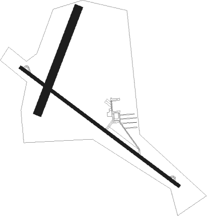
Runway info
Runway 13 / 31  | ||
| length | 1263m (4144ft) | |
| bearing | 123° / 303° | |
| width | 21m (70ft) | |
| surface | asphalt | |
| displ threshold | 0m (0ft) / 344m (1129ft) | |
| Runway 03 / 21 | ||
| length | 701m (2300ft) | |
| bearing | 33° / 213° | |
| width | 55m (180ft) | |
| surface | grass | |
Nearby beacons
| code | identifier | dist | bearing | frequency |
|---|---|---|---|---|
| GIJ | GIPPER (NILES) VORTAC | 11.1 | 165° | 115.40 |
| ELX | KEELER VOR/DME | 15.9 | 52° | 116.60 |
| SB | MISHA (SOUTH BEND) NDB | 16.1 | 149° | 341 |
| GSH | GOSHEN VORTAC | 29.7 | 141° | 113.70 |
| PMM | PULLMAN VOR/DME | 33 | 27° | 112.10 |
| VP | SEDLY (VALPARAISO) NDB | 37.7 | 226° | 212 |
| AZ | AUSTN (KALAMAZOO) NDB | 38.9 | 78° | 371 |
| OXI | KNOX VOR/DME | 39.8 | 204° | 115.60 |
| AZO | KALAMAZOO VOR/DME | 40.1 | 71° | 109 |
| IRS | STURGIS NDB | 42.5 | 98° | 382 |
| GY | GARIE (GARY) NDB | 48.6 | 248° | 236 |
| OLK | WEBSTER LAKE VOR | 57.5 | 129° | 110.40 |
| VIO | VICTORY VOR/DME | 63.3 | 46° | 115.95 |
| GR | KNOBS (GRAND RAPIDS) NDB | 71.7 | 46° | 263 |
Instrument approach procedures
| runway | airway (heading) | route (dist, bearing) |
|---|---|---|
| RW13 | JABDA (145°) | JABDA STNGG (13mi, 167°) 3000ft |
| RW13 | STNGG (123°) | STNGG 3000ft |
| RW13 | TOYED (97°) | TOYED STNGG (7mi, 57°) 3000ft |
| RNAV | STNGG 3000ft ALLII (5mi, 123°) 2400ft SLOGS (3mi, 123°) 1600ft C20 (3mi, 123°) 709ft (5243mi, 116°) 1074ft AUSTJ (5235mi, 296°) 3000ft AUSTJ (turn) | |
| RW31 | AUSTJ (303°) | AUSTJ 3000ft |
| RW31 | LINGS (281°) | LINGS AUSTJ (14mi, 267°) 3000ft |
| RNAV | AUSTJ 3000ft ADDDY (5mi, 303°) 2400ft HITOM (3mi, 303°) 1600ft C20 (3mi, 304°) 714ft (5243mi, 116°) 1074ft STNGG (5251mi, 296°) 3000ft STNGG (turn) |
Disclaimer
The information on this website is not for real aviation. Use this data with the X-Plane flight simulator only! Data taken with kind consent from X-Plane 12 source code and data files. Content is subject to change without notice.