Brodhead
Airport details
| Country | United States of America |
| State | Wisconsin |
| Region | |
| Airspace | Chicago Ctr |
| Municipality | Town of Spring Grove |
| Elevation | 791ft (241m) |
| Timezone | GMT -6 |
| Coordinates | 42.59673, -89.38874 |
| Magnetic var | |
| Type | land |
| Available since | X-Plane v10.40 |
| ICAO code | C37 |
| IATA code | n/a |
| FAA code | C37 |
Communication
Nearby Points of Interest:
Francis West Smith House
-West Luther Valley Lutheran Church
-Risum Round Barn
-Orfordville Depot
-Charles Fehr Round Barn
-Janet Jennings House
-Jacob Regez, Sr. House
-General Francis H. West House
-Gen. James Bintliff House
-Green County Courthouse
-Monroe Water Tower
-Monroe Commercial District
-Cleveland's Hall and Blacksmith Shop
-Freitag's Pure Oil Service Station
-First Methodist Church
-Robert Weber Round Barn
-People's State Bank
-AF and AM Lodge 687
-Union House
-William Ritzman House
-Cooksville Cheese Factory
-Francis Marian Ames Farmstead
-Macktown Historic District
-Hefty–Blum Farmstead
-H.D. Jameson House
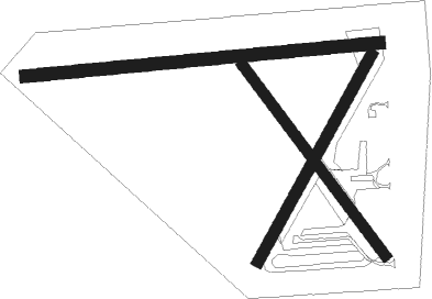
Runway info
Runway 09 / 27  | ||
| length | 966m (3169ft) | |
| bearing | 89° / 269° | |
| width | 35m (115ft) | |
| surface | grass | |
| displ threshold | 71m (233ft) / 150m (492ft) | |
| Runway 03 / 21 | ||
| length | 641m (2103ft) | |
| bearing | 42° / 222° | |
| width | 30m (100ft) | |
| surface | grass | |
| Runway 15 / 33 | ||
| length | 645m (2116ft) | |
| bearing | 139° / 319° | |
| width | 30m (100ft) | |
| surface | grass | |
Nearby beacons
| code | identifier | dist | bearing | frequency |
|---|---|---|---|---|
| JVL | JANESVILLE VOR/DME | 12.7 | 98° | 114.30 |
| RFD | DME | 23.8 | 153° | 110.80 |
| MSN | MADISON VORTAC | 32.9 | 5° | 108.60 |
| PLL | POLO VOR/DME | 38.3 | 192° | 111.20 |
| RYV | ROCK RIVER (WATERTOWN) NDB | 45.3 | 49° | 371 |
| LNR | ROCK DME | 53.1 | 313° | 116.05 |
| UNU | JUNEAU NDB | 58.3 | 40° | 344 |
| DLL | DELLS (BARABOO) VORTAC | 59.6 | 339° | 117 |
Disclaimer
The information on this website is not for real aviation. Use this data with the X-Plane flight simulator only! Data taken with kind consent from X-Plane 12 source code and data files. Content is subject to change without notice.