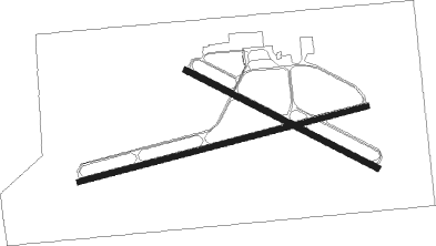
Dixon
Airport details
| Country | United States of America |
| State | Illinois |
| Region | K5 |
| Airspace | Chicago Ctr |
| Municipality | Dixon |
| Elevation | 785ft (239m) |
| Timezone | GMT -6 |
| Coordinates | 41.83370, -89.44621 |
| Magnetic var | |
| Type | land |
| Available since | X-Plane v10.40 |
| ICAO code | C73 |
| IATA code | n/a |
| FAA code | n/a |
Communication
| Dixon CTAF/UNICOM | 123.050 |
| Dixon ROCKFORD Approach/Departure | 126.000 |
Nearby Points of Interest:
John Deere House and Shop
-William H. Van Epps House
-Dixon Downtown Historic District
-Christopher Brookner House
-Illinois Central Stone Arch Railroad Bridges
-Col. Nathan Whitney House
-Amboy Illinois Central Depot
-Buffalo Township Public Library
-Bryant H. and Lucie Barber House
-Henry D. Barber House
-Polo Independent Order of Odd Fellows Lodge No. 197
-Buffalo Grove Lime Kiln
-John McGrath House
-Zenas Aplington House
-Dr. William Burns House
-David and Julia Watson House
-Chicago, Burlington and Quincy Railroad Depot
-Fulton Commercial Historic District
-Sterling Masonic Temple
-Ogle County Courthouse
-Oregon Public Library
-Oregon Commercial Historic District
-Pinehill Inn
-Samuel M. Hitt House
-Joseph Steffens House

Nearby beacons
| code | identifier | dist | bearing | frequency |
|---|---|---|---|---|
| PLL | POLO VOR/DME | 8.6 | 329° | 111.20 |
| RFD | DME | 25.9 | 32° | 110.80 |
| BDF | BRADFORD VORTAC | 40.9 | 192° | 114.70 |
| FN | HILLZ (CLINTON) NDB | 42.5 | 265° | 517 |
| JVL | JANESVILLE VOR/DME | 46 | 25° | 114.30 |
| GBG | DME | 69.8 | 228° | 109.80 |
Instrument approach procedures
| runway | airway (heading) | route (dist, bearing) |
|---|---|---|
| RW08 | MIHAL (106°) | MIHAL UVOVE (12mi, 135°) 2700ft |
| RW08 | UVOVE (82°) | UVOVE 2700ft |
| RW08 | WYNET (17°) | WYNET OVAPE (18mi, 335°) 2700ft UVOVE (6mi, 346°) 2700ft |
| RNAV | UVOVE 2700ft MINNR (7mi, 82°) 2400ft C73 (5mi, 82°) 822ft (5380mi, 115°) 2100ft PLL (5384mi, 295°) 2700ft PLL (turn) | |
| RW26 | ANCUT (262°) | ANCUT 2700ft |
| RW26 | CHANA (240°) | CHANA ANCUT (6mi, 180°) 2700ft |
| RW26 | WEPTA (287°) | WEPTA ANCUT (7mi, 347°) 2700ft |
| RNAV | ANCUT 2700ft WLLOW (6mi, 262°) 2400ft C73 (5mi, 262°) 824ft JAVNI (6mi, 262°) PLL (9mi, 18°) 2700ft PLL (turn) |
Disclaimer
The information on this website is not for real aviation. Use this data with the X-Plane flight simulator only! Data taken with kind consent from X-Plane 12 source code and data files. Content is subject to change without notice.