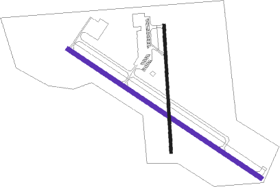
Lacon - Marshall County
Airport details
| Country | United States of America |
| State | Illinois |
| Region | K5 |
| Airspace | Chicago Ctr |
| Municipality | Marshall County |
| Elevation | 583ft (178m) |
| Timezone | GMT -6 |
| Coordinates | 41.01883, -89.38578 |
| Magnetic var | |
| Type | land |
| Available since | X-Plane v10.40 |
| ICAO code | C75 |
| IATA code | n/a |
| FAA code | n/a |
Communication
| Marshall County AWOS 3 | 119.425 |
| Marshall County CTAF/UNICOM | 122.800 |
Nearby Points of Interest:
Robert Waugh House
-Cortland Condit House
-Adlai E. Stevenson I House
-Putnam County Courthouse
-Joseph Schertz House
-Edward Pulsifer House
-Benson Water Tower
-Stevens House
-Chicago, Burlington & Quincy Railroad Depot
-Washington C. Wear House
-Dement-Zinser House
-Denhart Bank Building
-Eureka College Administration Building and Chapel
-Peoria Waterworks
-Illinois Waterway Project Office
-John C. Flanagan House Museum
-North Side Historic District
-Farm Creek Section
-Richard M. Skinner House
-Greenwood Cottage
-Judge Jacob Gale House
-Owen Lovejoy House
-YWCA Building
-Kickapoo Building
-Grand Army of the Republic Memorial Hall
Nearby beacons
| code | identifier | dist | bearing | frequency |
|---|---|---|---|---|
| BDF | BRADFORD VORTAC | 12.4 | 305° | 114.70 |
| PI | TUNGG (PEORIA) NDB | 26.5 | 207° | 356 |
| PIA | PEORIA VORTAC | 27.4 | 230° | 115.20 |
| PNT | PONTIAC VOR/DME | 31.8 | 107° | 109.60 |
| LH | EGROW (BLOOMINGTON-NORMAL) NDB | 36 | 132° | 334 |
| BMI | BLOOMINGTON VOR/DME | 38.3 | 140° | 108.20 |
| DTG | DWIGHT NDB | 43.6 | 83° | 344 |
| AAA | ABRAHAM (LINCOLN) NDB | 51.6 | 177° | 329 |
| PLL | POLO VOR/DME | 57.2 | 352° | 111.20 |
Instrument approach procedures
| runway | airway (heading) | route (dist, bearing) |
|---|---|---|
| RW13 | OWENA (210°) | OWENA ZEPEB (14mi, 251°) 2500ft YULUB (8mi, 226°) 2500ft |
| RW13 | PIA (50°) | PIA WANLU (22mi, 14°) 2500ft YULUB (8mi, 46°) 2500ft |
| RW13 | YULUB (121°) | YULUB 2500ft |
| RNAV | YULUB 2500ft GUGBE (6mi, 121°) 2400ft XUVTY (4mi, 121°) 1220ft C75 (2mi, 120°) 589ft (5377mi, 115°) 1000ft YULUB (5387mi, 295°) 2500ft YULUB (turn) |
Disclaimer
The information on this website is not for real aviation. Use this data with the X-Plane flight simulator only! Data taken with kind consent from X-Plane 12 source code and data files. Content is subject to change without notice.

