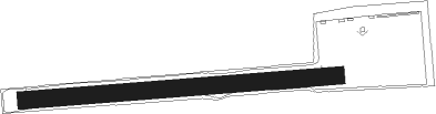
Lodi - Lodi Lakeland
Airport details
| Country | United States of America |
| State | Wisconsin |
| Region | |
| Airspace | Chicago Ctr |
| Municipality | Town of Lodi |
| Elevation | 844ft (257m) |
| Timezone | GMT -6 |
| Coordinates | 43.32670, -89.52599 |
| Magnetic var | |
| Type | land |
| Available since | X-Plane v10.40 |
| ICAO code | C76 |
| IATA code | n/a |
| FAA code | 9WN5 |
Communication
Nearby Points of Interest:
Frank T. and Polly Lewis House
-John A. and Martha Robertson House
-Portage Street Historic District
-Job Mills Block
-Joel M. Pruyn Block
-Richard W. and Margaret Mills House
-Lodi Street-Prairie Street Historic District
-Clara F. Bacon House
-Daniel and Nellie Byrns House
-Goeres Park
-Merrimac Ferry
-Durward's Glen
-Baraboo Range
-Lachmund Family House
-Sauk City Fire Station
-Frederick Schumann Farmstead
-Wisconsin Heights Battlefield
-John and Margarethe Kemp Cabin
-Ice Age Trail
-St. Peter's Roman Catholic Church
-Point of Rocks
-Sauk County Courthouse
-Walworth D. Porter Duplex Residence
-Zona Gale House
-Portage Industrial Waterfront Historic District
Nearby beacons
| code | identifier | dist | bearing | frequency |
|---|---|---|---|---|
| MSN | MADISON VORTAC | 13.6 | 134° | 108.60 |
| DLL | DELLS (BARABOO) VORTAC | 16.9 | 313° | 117 |
| LNR | ROCK DME | 26.6 | 267° | 116.05 |
| RYV | ROCK RIVER (WATERTOWN) NDB | 36.2 | 101° | 371 |
| UNU | JUNEAU NDB | 36.4 | 83° | 344 |
| DAF | NECEDAH NDB | 48.8 | 322° | 233 |
| VOK | VOLK (CAMP DOUGLAS) TACAN | 48.8 | 310° | 110.40 |
| JVL | JANESVILLE VOR/DME | 49.7 | 151° | 114.30 |
| OS | POBER (OSHKOSH) NDB | 53.4 | 61° | 395 |
| OSH | OSHKOSH VORTAC | 58 | 56° | 116.75 |
Disclaimer
The information on this website is not for real aviation. Use this data with the X-Plane flight simulator only! Data taken with kind consent from X-Plane 12 source code and data files. Content is subject to change without notice.