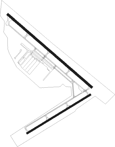
Byron
Airport details
| Country | United States of America |
| State | California |
| Region | K2 |
| Airspace | Oakland Ctr |
| Municipality | Contra Costa County |
| Elevation | 78ft (24m) |
| Timezone | GMT -8 |
| Coordinates | 37.82845, -121.62583 |
| Magnetic var | |
| Type | land |
| Available since | X-Plane v10.40 |
| ICAO code | C83 |
| IATA code | n/a |
| FAA code | C83 |
Communication
| Byron Byron AWOS | 123.775 |
| Byron Byron CTAF/UNICOM | 123.050 |
| Byron NORCAL Approach/Departure | 123.850 |
Nearby Points of Interest:
Bank of Tracy
-Tracy City Hall and Jail
-Bank of Italy
-Livermore Carnegie Library and Park
-Black Diamond Mines Regional Preserve
-Roswell Butler Hard House
-Riverview Union High School Building
-Wong K. Gew Mansion
-Tretheway Block
-Hastings Adobe
-United States Post Office (Stockton, California)
-Danville station
-Elks Building
-Old Borges Ranch
-John Ohm House
-Isleton Chinese and Japanese Commercial Districts
-Don Francisco Galindo House
-Patrick Rodgers Farm
-William T. Hendrick House
-Port Chicago Naval Magazine National Memorial
-Meek Mansion
-Woman's Club of Lodi
-Woodbridge Masonic Lodge No. 131
-Lodi Arch
-I.O.O.F. Hall

Nearby beacons
| code | identifier | dist | bearing | frequency |
|---|---|---|---|---|
| LV | REIGA (LIVERMORE) NDB | 8.6 | 203° | 374 |
| CCR | CONCORD VOR/DME | 23.7 | 297° | 117 |
| OAK | OAKLAND VOR/DME | 29 | 260° | 116.80 |
| SUU | TRAVIS (FAIRFIELD) TACAN | 29.2 | 323° | 116.60 |
| SJC | SAN JOSE VOR/DME | 31.1 | 215° | 114.10 |
| NUQ | MOFFETT (MOUNTAIN VIEW) TACAN | 31.4 | 227° | 117.60 |
| LIN | LINDEN VOR/DME | 32.9 | 68° | 114.80 |
| MOD | MODESTO VOR/DME | 33.9 | 107° | 114.60 |
| SAC | SACRAMENTO VORTAC | 37.1 | 7° | 115.20 |
| SFO | SAN FRANCISCO VOR/DME | 37.6 | 254° | 115.80 |
| OSI | WOODSIDE VOR/DME | 40.7 | 236° | 113.90 |
| SGD | SCAGGS ISLAND (NAPA) VORTAC | 41.1 | 295° | 112.10 |
| SAU | SAUSALITO VOR/DME | 42.5 | 272° | 116.20 |
| MCC | MC CLELLAN (SACRAMENTO) VOR/DME | 51.4 | 15° | 109.20 |
| HNW | HANGTOWN (PLACERVILLE) VOR/DME | 67.8 | 44° | 115.50 |
Instrument approach procedures
| runway | airway (heading) | route (dist, bearing) |
|---|---|---|
| RW30 | SMONE (318°) | SMONE DASVE (5mi, 323°) 4900ft MOVDD (4mi, 326°) 3000ft |
| RNAV | MOVDD 3000ft BABPI (6mi, 320°) 2600ft CUDUG (4mi, 309°) 1140ft C83 (3mi, 307°) 79ft (6875mi, 107°) 1000ft HAIRE (6866mi, 287°) 4000ft HAIRE (turn) |
Disclaimer
The information on this website is not for real aviation. Use this data with the X-Plane flight simulator only! Data taken with kind consent from X-Plane 12 source code and data files. Content is subject to change without notice.