Sturtevant - Sylvania
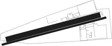
Airport details
| Country | United States of America |
| State | Wisconsin |
| Region | |
| Airspace | Chicago Ctr |
| Municipality | Town of Yorkville |
| Elevation | 785ft (239m) |
| Timezone | GMT -6 |
| Coordinates | 42.70288, -87.96266 |
| Magnetic var | |
| Type | land |
| Available since | X-Plane v10.40 |
| ICAO code | C89 |
| IATA code | n/a |
| FAA code | C89 |
Communication
Nearby Points of Interest:
George Murray House
-Lincoln School
-Uptown Theater
-Racine Depot
-Mitchell Lewis Building
-George Bray Neighborhood Center
-Racine College
-Rickeman Grocery Building
-No. 4 Engine House
-Johnson Wax Headquarters
-Racine County Courthouse
-Thomas P. Hardy House
-Chauncey Hall House
-Kaiser's
-Eli R. Cooley House
-Karel Jonas House
-St. Luke's Episcopal Church, Chapel, Guildhall, and Rectory
-Badger Building
-Chauncey Hall Building
-Old Main Street Historic District
-McClurg Building
-Hansen House (Racine, Wisconsin)
-Racine Elks Club, Lodge No. 252
-Memorial Hall
-Washington Park Clubhouse

Nearby beacons
| code | identifier | dist | bearing | frequency |
|---|---|---|---|---|
| RA | PASER (RACINE) NDB | 3 | 108° | 206 |
| ENW | DME | 6.3 | 163° | 109.20 |
| HRK | (RACINE) DME | 7.4 | 68° | 117.70 |
| BUU | (BURLINGTON) DME | 14.9 | 268° | 114.50 |
| UG | WAUKE (CHICAGO/WAUKEGAN) NDB | 16 | 146° | 379 |
| LJT | (MILWAUKEE) DME | 24.6 | 350° | 115.65 |
| BAE | BADGER (MILWAUKEE) VOR/DME | 28.6 | 322° | 116.40 |
| OBK | NORTHBROOK VOR/DME | 28.9 | 179° | 113 |
| GCO | DME | 42.6 | 175° | 108.25 |
| BJB | WEST BEND VOR | 43.7 | 347° | 109.80 |
| RYV | ROCK RIVER (WATERTOWN) NDB | 43.8 | 302° | 371 |
| DPA | DUPAGE (CHICAGO) VOR/DME | 51.7 | 205° | 108.40 |
| UNU | JUNEAU NDB | 54.3 | 314° | 344 |
| MX | KEDZI (CHICAGO) NDB | 58.9 | 164° | 248 |
Disclaimer
The information on this website is not for real aviation. Use this data with the X-Plane flight simulator only! Data taken with kind consent from X-Plane 12 source code and data files. Content is subject to change without notice.