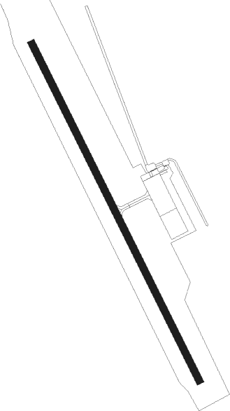
Valemount
Airport details
| Country | Canada |
| State | British Columbia |
| Region | CY |
| Airspace | Vancouver Ctr |
| Municipality | Area H (Robson Valley/Canoe) |
| Elevation | 2615ft (797m) |
| Timezone | GMT -7 |
| Coordinates | 52.85275, -119.33626 |
| Magnetic var | |
| Type | land |
| Available since | X-Plane v10.40 |
| ICAO code | CAH4 |
| IATA code | n/a |
| FAA code | n/a |
Communication
| Valemount UNICOM / Traffic | 123.200 |
Departure and arrival routes
| Transition altitude | 18000ft |
| Transition level | 18000ft |
| SID end points | distance | outbound heading | |
|---|---|---|---|
| RW32 | |||
| IRDIM1 | 25mi | 299° | |
Instrument approach procedures
| runway | airway (heading) | route (dist, bearing) |
|---|---|---|
| RWNVA | OMTOR (104°) | OMTOR ONDAN (8mi, 46°) 10300ft AGNEK (7mi, 110°) 8700ft |
| RWNVA | PEVMA (116°) | PEVMA ONDAN (8mi, 110°) 10000ft AGNEK (7mi, 110°) 8700ft |
| RWNVA | PIBTO (133°) | PIBTO ONDAN (8mi, 226°) 10200ft AGNEK (7mi, 110°) 8700ft |
| RNAV | AGNEK 8700ft MUSOB (8mi, 110°) 7300ft DESGI (4mi, 129°) 7000ft OMROX (5mi, 129°) 6900ft MUSLU (15mi, 115°) 10100ft MUSLU (turn) | |
| RWNVB | OMTOR (104°) | OMTOR ONDAN (8mi, 46°) 10300ft AGNEK (7mi, 110°) 8700ft |
| RWNVB | PEVMA (116°) | PEVMA ONDAN (8mi, 110°) 10000ft AGNEK (7mi, 110°) 8700ft |
| RWNVB | PIBTO (133°) | PIBTO ONDAN (8mi, 226°) 10200ft AGNEK (7mi, 110°) 8700ft |
| RNAV | AGNEK 8700ft MUSOB (8mi, 110°) 7300ft DESGI (4mi, 129°) 5620ft OMROX (5mi, 129°) 4020ft MUSLU (15mi, 115°) 10100ft MUSLU (turn) 10100ft |
Disclaimer
The information on this website is not for real aviation. Use this data with the X-Plane flight simulator only! Data taken with kind consent from X-Plane 12 source code and data files. Content is subject to change without notice.
