Winterland
Airport details
| Country | Canada |
| State | Newfoundland and Labrador |
| Region | CY |
| Airspace | Gander Oceanic Ctr |
| Municipality | Winterland |
| Elevation | 153ft (47m) |
| Timezone | GMT -3.5 |
| Coordinates | 47.13706, -55.32915 |
| Magnetic var | |
| Type | land |
| Available since | X-Plane v10.40 |
| ICAO code | CCC2 |
| IATA code | n/a |
| FAA code | n/a |
Communication
| Winterland CTAF | 123.200 |
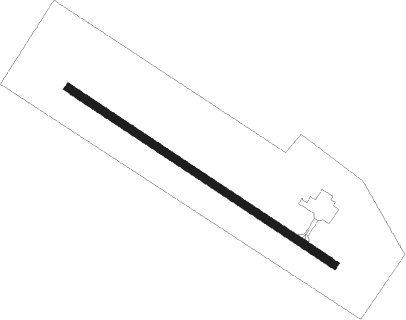
Runway info
| Runway 15 / 33 | ||
| length | 912m (2992ft) | |
| bearing | 118° / 298° | |
| width | 23m (75ft) | |
| surface | asphalt | |
Nearby beacons
| code | identifier | dist | bearing | frequency |
|---|---|---|---|---|
| 7H | MARYSTOWN (WINTERLAND) NDB | 0.1 | 88° | 234 |
| Y | GALLANTRY HEAD (ST PIERRE) NDB | 40.8 | 246° | 342 |
| SP | ST. PIERRE NDB | 41.1 | 246° | 386 |
Instrument approach procedures
| runway | airway (heading) | route (dist, bearing) |
|---|---|---|
| RW33 | BIVMU (278°) | BIVMU HOUNT (5mi, 229°) 1900ft |
| RW33 | ELVEM (335°) | ELVEM HOUNT (7mi, 49°) 1900ft |
| RNAV | HOUNT 1900ft VOGAT (5mi, 298°) 1880ft SAXUV (2mi, 298°) 1200ft CCC2 (3mi, 298°) 193ft UDBIV (5mi, 298°) 2400ft UDBIV (turn) |
Disclaimer
The information on this website is not for real aviation. Use this data with the X-Plane flight simulator only! Data taken with kind consent from X-Plane 12 source code and data files. Content is subject to change without notice.