Juniper
Airport details
| Country | Canada |
| State | New Brunswick |
| Region | CY |
| Airspace | Moncton Ctr |
| Municipality | Aberdeen Parish |
| Elevation | 835ft (255m) |
| Timezone | GMT -4 |
| Coordinates | 46.56270, -67.16840 |
| Magnetic var | |
| Type | land |
| Available since | X-Plane v10.40 |
| ICAO code | CCE3 |
| IATA code | n/a |
| FAA code | n/a |
Communication
| Juniper CTAF | 123.200 |
Nearby Points of Interest:
Aroostook station
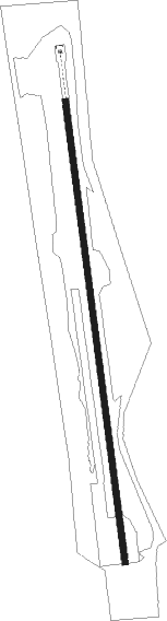
Runway info
| Runway 02 / 20 | ||
| length | 1219m (3999ft) | |
| bearing | 356° / 176° | |
| width | 16m (53ft) | |
| surface | asphalt | |
Nearby beacons
| code | identifier | dist | bearing | frequency |
|---|---|---|---|---|
| PQI | PRESQUE ISLE VOR/DME | 40.2 | 283° | 116.40 |
| HUL | DME | 41.8 | 232° | 116.10 |
| FC | FREDERICTON NDB | 45.3 | 139° | 326 |
| YFC | FREDERICTON VOR/DME | 50.7 | 132° | 113 |
Instrument approach procedures
| runway | airway (heading) | route (dist, bearing) |
|---|---|---|
| RW02 | LITMI (19°) | LITMI MEPMO (6mi, 77°) 2800ft |
| RW02 | PEVBU (310°) | PEVBU MEPMO (6mi, 258°) 2800ft |
| RNAV | MEPMO 2800ft SEVMA (8mi, 335°) 2500ft TADRU (2mi, 356°) 1750ft CCE3 (3mi, 356°) 887ft MUVSA (7mi, 334°) 2900ft MUVSA (turn) 2900ft | |
| RW20 | IKMIR (133°) | IKMIR EMPID (6mi, 86°) 3400ft |
| RW20 | KIXOS (215°) | KIXOS EMPID (6mi, 266°) 3400ft |
| RNAV | EMPID 3400ft ALTUG (6mi, 172°) 2300ft DUXUX (2mi, 172°) 1600ft CCE3 (3mi, 172°) 879ft NUGAX (7mi, 171°) 2900ft NUGAX (turn) |
Disclaimer
The information on this website is not for real aviation. Use this data with the X-Plane flight simulator only! Data taken with kind consent from X-Plane 12 source code and data files. Content is subject to change without notice.