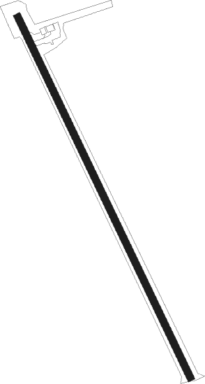
Florenceville
Airport details
| Country | Canada |
| State | New Brunswick |
| Region | CY |
| Airspace | Moncton Ctr |
| Municipality | Simonds Parish |
| Elevation | 505ft (154m) |
| Timezone | GMT -4 |
| Coordinates | 46.42615, -67.62798 |
| Magnetic var | |
| Type | land |
| Available since | X-Plane v10.40 |
| ICAO code | CCR3 |
| IATA code | n/a |
| FAA code | n/a |
Communication
| Florenceville CTAF | 122.800 |
Runway info
| Runway 18 / 36 | ||
| length | 1652m (5420ft) | |
| bearing | 151° / 331° | |
| width | 30m (100ft) | |
| surface | asphalt | |
Nearby beacons
| code | identifier | dist | bearing | frequency |
|---|---|---|---|---|
| HUL | DME | 24.7 | 208° | 116.10 |
| PQI | PRESQUE ISLE VOR/DME | 28.4 | 307° | 116.40 |
| LNT | MILNOT (MILLINOCKET) NDB | 60.4 | 230° | 344 |
| MLT | MILLINOCKET VOR/DME | 62.5 | 227° | 117.90 |
Instrument approach procedures
| runway | airway (heading) | route (dist, bearing) |
|---|---|---|
| RW18-Y | DUPIK (133°) | DUPIK IKDAL (5mi, 107°) 2800ft |
| RW18-Y | ESTAT (160°) | ESTAT IKDAL (5mi, 178°) 2800ft |
| RW18-Y | VEVMI (198°) | VEVMI IKDAL (6mi, 255°) 2800ft |
| RNAV | IKDAL 2800ft VOLAV (5mi, 151°) 1900ft MITIM (3mi, 151°) 990ft CCR3 (2mi, 151°) 545ft APDOL (5mi, 151°) 3100ft APDOL (turn) | |
| RW18-Z | DUPIK (133°) | DUPIK IKDAL (5mi, 107°) 2800ft |
| RW18-Z | ESTAT (160°) | ESTAT IKDAL (5mi, 178°) 2800ft |
| RW18-Z | VEVMI (198°) | VEVMI IKDAL (6mi, 255°) 2800ft |
| RNAV | IKDAL 2800ft VOLAV (5mi, 151°) 1900ft CCR3 (5mi, 151°) 545ft APDOL (5mi, 151°) 3100ft APDOL (turn) | |
| RW36-Y | AGNUN (2°) | AGNUN WOTTI (6mi, 50°) 2100ft |
| RW36-Y | GABUK (306°) | GABUK WOTTI (6mi, 277°) 2100ft |
| RNAV | WOTTI 2100ft DUSIN (6mi, 331°) 1500ft ALVOV (1mi, 331°) 1130ft CCR3 (2mi, 331°) 494ft MISUP (5mi, 331°) 3100ft MISUP (turn) | |
| RW36-Z | AGNUN (2°) | AGNUN WOTTI (6mi, 50°) 2100ft |
| RW36-Z | GABUK (306°) | GABUK WOTTI (6mi, 277°) 2100ft |
| RNAV | WOTTI 2100ft DUSIN (6mi, 331°) 1500ft ALVOV (1mi, 331°) 1130ft CCR3 (2mi, 331°) 494ft MISUP (5mi, 331°) 3100ft MISUP (turn) |
Disclaimer
The information on this website is not for real aviation. Use this data with the X-Plane flight simulator only! Data taken with kind consent from X-Plane 12 source code and data files. Content is subject to change without notice.
