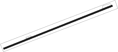
Buctouche
Airport details
| Country | Canada |
| State | New Brunswick |
| Region | CY |
| Airspace | Moncton Ctr |
| Municipality | Wellington Parish |
| Elevation | 57ft (17m) |
| Timezone | GMT -4 |
| Coordinates | 46.50937, -64.69381 |
| Magnetic var | |
| Type | land |
| Available since | X-Plane v10.40 |
| ICAO code | CDT5 |
| IATA code | n/a |
| FAA code | n/a |
Communication
| BUCTOUCHE CTAF | 123.200 |
Nearby beacons
| code | identifier | dist | bearing | frequency |
|---|---|---|---|---|
| YQM | MONCTON VOR/DME | 19.9 | 159° | 117.30 |
| QM | MONCTON NDB | 24.3 | 164° | 224 |
| ZMN | LEWISVILLE (MONCTON) NDB | 24.6 | 194° | 366 |
| ZQM | RIVERVIEW (MONCTON) NDB | 28.5 | 191° | 304 |
| 5B | SUMMERSIDE NDB | 34.2 | 98° | 254 |
| F9 | MIRAMICHI NDB | 43.7 | 303° | 520 |
Instrument approach procedures
| runway | airway (heading) | route (dist, bearing) |
|---|---|---|
| RW09 | TIDOD (65°) | TIDOD OMSAK (6mi, 42°) 1500ft |
| RNAV | OMSAK 1400ft ETLUK (5mi, 78°) 1200ft CDT5 (3mi, 78°) 107ft OISTR (5mi, 78°) 1500ft OISTR (turn) | |
| RW27 | DUVAR (280°) | DUVAR DUTUS (5mi, 336°) 1300ft |
| RW27 | ILIRO (233°) | ILIRO DUTUS (5mi, 156°) 1300ft |
| RNAV | DUTUS 1300ft EBMUK (5mi, 258°) 1000ft CDT5 (3mi, 258°) 75ft VIDVO (5mi, 258°) 1500ft VIDVO (turn) |
Disclaimer
The information on this website is not for real aviation. Use this data with the X-Plane flight simulator only! Data taken with kind consent from X-Plane 12 source code and data files. Content is subject to change without notice.
