Fogo
Airport details
| Country | Canada |
| State | Newfoundland and Labrador |
| Region | CY |
| Airspace | Gander Oceanic Ctr |
| Municipality | Fogo Island |
| Elevation | 80ft (24m) |
| Timezone | GMT -3.5 |
| Coordinates | 49.65740, -54.23743 |
| Magnetic var | |
| Type | land |
| Available since | X-Plane v10.40 |
| ICAO code | CDY3 |
| IATA code | n/a |
| FAA code | n/a |
Communication
| Fogo CTAF | 123.200 |
Nearby Points of Interest:
Boyd's Cove Beothuk
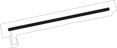
Runway info
| Runway 10 / 28 | ||
| length | 898m (2946ft) | |
| bearing | 85° / 265° | |
| width | 24m (80ft) | |
| surface | asphalt | |
| blast zone | 6m (20ft) / 5m (16ft) | |
Nearby beacons
| code | identifier | dist | bearing | frequency |
|---|---|---|---|---|
| 7C | FOGO NDB | 0.3 | 299° | 237 |
| QX | GANDER NDB | 44.9 | 212° | 280 |
| YQX | GANDER VOR/DME | 46.9 | 201° | 112.70 |
Instrument approach procedures
| runway | airway (heading) | route (dist, bearing) |
|---|---|---|
| RW10 | EPNAM (67°) | EPNAM OBVIG (5mi, 349°) 1400ft |
| RW10 | VOBOG (102°) | VOBOG OBVIG (5mi, 169°) 1400ft |
| RNAV | OBVIG 1400ft XUKAG (6mi, 85°) 1400ft CDY3 (4mi, 85°) 142ft XESAP (5mi, 85°) 1600ft XESAP (turn) | |
| RW28 | XEVIN (283°) | XEVIN AMBEM (5mi, 349°) 1500ft |
| RW28 | XORTU (247°) | XORTU AMBEM (5mi, 169°) 1500ft |
| RNAV | AMBEM 1500ft ALTED (6mi, 265°) 1480ft CDY3 (4mi, 265°) 141ft ELEBI (5mi, 265°) 1600ft ELEBI (turn) |
Disclaimer
The information on this website is not for real aviation. Use this data with the X-Plane flight simulator only! Data taken with kind consent from X-Plane 12 source code and data files. Content is subject to change without notice.