Red Earth Creek
Airport details
| Country | Canada |
| State | Alberta |
| Region | CY |
| Airspace | Edmonton Ctr |
| Municipality | Municipal District of Opportunity |
| Elevation | 1790ft (546m) |
| Timezone | GMT -7 |
| Coordinates | 56.54611, -115.27556 |
| Magnetic var | |
| Type | land |
| Available since | X-Plane v10.40 |
| ICAO code | CEH5 |
| IATA code | n/a |
| FAA code | n/a |
Communication
| Red Earth Creek CTAF | 123.200 |
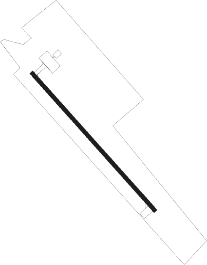
Runway info
| Runway 13 / 31 | ||
| length | 1078m (3537ft) | |
| bearing | 126° / 306° | |
| width | 23m (75ft) | |
| surface | asphalt | |
Instrument approach procedures
| runway | airway (heading) | route (dist, bearing) |
|---|---|---|
| RW13-Y | LIBIX (150°) | LIBIX IKNET (6mi, 217°) 3500ft |
| RW13-Y | SASIG (109°) | SASIG IKNET (6mi, 86°) 3500ft |
| RNAV | IKNET 3500ft APNIL (6mi, 126°) 3450ft CEH5 (5mi, 126°) 1816ft OMIVI (7mi, 126°) 3900ft OMIVI (turn) | |
| RW13-Z | LIBIX (150°) | LIBIX IKNET (6mi, 217°) 3500ft |
| RW13-Z | SASIG (109°) | SASIG IKNET (6mi, 86°) 3500ft |
| RNAV | IKNET 3500ft APNIL (6mi, 126°) 3450ft CEH5 (5mi, 126°) 1816ft OMIVI (7mi, 126°) 3900ft OMIVI (turn) | |
| RW31-Y | ANVOM (330°) | ANVOM IGVON (6mi, 37°) 3500ft |
| RW31-Y | DUMDA (290°) | DUMDA IGVON (6mi, 266°) 3500ft |
| RNAV | IGVON 3500ft TOTER (6mi, 306°) 3500ft CEH5 (5mi, 306°) 1839ft LEVAM (7mi, 306°) 3900ft LEVAM (turn) | |
| RW31-Z | ANVOM (330°) | ANVOM IGVON (6mi, 37°) 3500ft |
| RW31-Z | DUMDA (290°) | DUMDA IGVON (6mi, 266°) 3500ft |
| RNAV | IGVON 3500ft TOTER (6mi, 306°) 3500ft CEH5 (5mi, 306°) 1839ft LEVAM (7mi, 306°) 3900ft LEVAM (turn) |
Disclaimer
The information on this website is not for real aviation. Use this data with the X-Plane flight simulator only! Data taken with kind consent from X-Plane 12 source code and data files. Content is subject to change without notice.