Morden
Airport details
| Country | Canada |
| State | Manitoba |
| Region | CY |
| Airspace | Winnipeg Ctr |
| Municipality | Rural Municipality of Stanley |
| Elevation | 950ft (290m) |
| Timezone | GMT -6 |
| Coordinates | 49.20791, -98.05640 |
| Magnetic var | |
| Type | land |
| Available since | X-Plane v10.40 |
| ICAO code | CJA3 |
| IATA code | n/a |
| FAA code | n/a |
Communication
| Morden CTAF/UNICOM | 123.000 |
Nearby Points of Interest:
Gingras Trading Post State Historic Site
-Walla Theatre
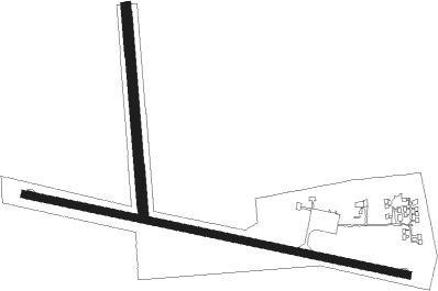
Runway info
Runway 10 / 28  | ||
| length | 1201m (3940ft) | |
| bearing | 101° / 281° | |
| width | 23m (75ft) | |
| surface | asphalt | |
| Runway 18 / 36 | ||
| length | 637m (2090ft) | |
| bearing | 180° / 360° | |
| width | 30m (100ft) | |
| surface | grass | |
Nearby beacons
| code | identifier | dist | bearing | frequency |
|---|---|---|---|---|
| PG | PORTAGE (PORTAGE LA PRAIRIE) NDB | 38.3 | 349° | 353 |
| LF | LA SALLE NDB | 39.4 | 60° | 336 |
| HML | HUMBOLDT TACAN | 42.1 | 110° | 112.40 |
| YPG | PORTAGE (PORTAGE LA PRAIR VOR/DME | 42.3 | 343° | 114.60 |
| ZWW | BOINE (WINNIPEG) NDB | 48.6 | 52° | 215 |
| WG | WINNIPEG NDB | 49.8 | 46° | 248 |
| ZHT | FORKS (WINNIPEG) NDB | 51.7 | 56° | 236 |
| YWG | WINNIPEG VORTAC | 53.6 | 49° | 115.50 |
| ZWN | DOWNS (WINNIPEG) NDB | 53.6 | 44° | 201 |
| ZWG | STONEY (WINNIPEG) NDB | 57.1 | 47° | 287 |
| UDE | DELTA NDB | 58.3 | 345° | 269 |
| BM | BALMORAL NDB | 62.9 | 39° | 375 |
Instrument approach procedures
| runway | airway (heading) | route (dist, bearing) |
|---|---|---|
| RW10 | ALILO (84°) | ALILO EBLAB (5mi, 24°) 2900ft |
| RW10 | DUVIP (120°) | DUVIP 4000ft EBLAB (5mi, 204°) 2900ft |
| RNAV | EBLAB 2900ft VODOS (6mi, 101°) 2600ft UKUDA (3mi, 101°) 1630ft CJA3 (2mi, 100°) 997ft BOROV (7mi, 101°) 3300ft BOROV (turn) | |
| RW18 | DASGI (228°) | DASGI AVTID (5mi, 278°) 3500ft |
| RW18 | MUSAV (196°) | MUSAV AVTID (5mi, 198°) 3500ft |
| RW18 | ONDON (157°) | ONDON AVTID (5mi, 98°) 3500ft |
| RNAV | AVTID 3500ft IGSUR (5mi, 198°) 2590ft CJA3 (5mi, 192°) 1000ft PURAP (3mi, 207°) 2500ft TUMEG (15mi, 278°) 3500ft TUMEG (turn) | |
| RW28 | MOBIG (301°) | MOBIG ETKAN (5mi, 24°) 2600ft |
| RW28 | NOTON (264°) | NOTON ETKAN (5mi, 204°) 2600ft |
| RNAV | ETKAN 2600ft APLUR (6mi, 281°) 2600ft CJA3 (5mi, 281°) 992ft UKTOD (7mi, 281°) 3300ft UKTOD (turn) |
Disclaimer
The information on this website is not for real aviation. Use this data with the X-Plane flight simulator only! Data taken with kind consent from X-Plane 12 source code and data files. Content is subject to change without notice.