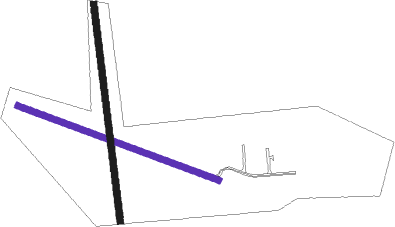
Humboldt
Airport details
| Country | Canada |
| State | Saskatchewan |
| Region | CY |
| Airspace | Winnipeg Ctr |
| Municipality | Humboldt No. 370 |
| Elevation | 1865ft (568m) |
| Timezone | GMT -6 |
| Coordinates | 52.17611, -105.13361 |
| Magnetic var | |
| Type | land |
| Available since | X-Plane v10.40 |
| ICAO code | CJU4 |
| IATA code | n/a |
| FAA code | n/a |
Communication
| Humboldt CTAF | 123.200 |
Nearby beacons
| code | identifier | dist | bearing | frequency |
|---|---|---|---|---|
| V2 | HUMBOLDT NDB | 0.3 | 99° | 277 |
| VX | DAFOE NDB | 27.6 | 118° | 368 |
Instrument approach procedures
| runway | airway (heading) | route (dist, bearing) |
|---|---|---|
| RW10 | DUPID (88°) | DUPID VIBKU (6mi, 36°) 3500ft |
| RW10 | RIDED (129°) | RIDED VIBKU (6mi, 216°) 3500ft |
| RNAV | VIBKU 3500ft BOPUK (6mi, 106°) 3500ft CJU4 (5mi, 105°) 1899ft MEDNU (7mi, 106°) 3300ft MEDNU (turn) | |
| RW28 | APGES (268°) | APGES EBGIK (6mi, 217°) 3500ft |
| RW28 | OBTOS (309°) | OBTOS EBGIK (6mi, 37°) 3500ft |
| RNAV | EBGIK 3500ft BOPOX (6mi, 286°) 3500ft IGVUL (2mi, 286°) 2850ft CJU4 (3mi, 286°) 1898ft MUREM (7mi, 285°) 3500ft MUREM (turn) |
Disclaimer
The information on this website is not for real aviation. Use this data with the X-Plane flight simulator only! Data taken with kind consent from X-Plane 12 source code and data files. Content is subject to change without notice.

