Neepawa
Airport details
| Country | Canada |
| State | Manitoba |
| Region | CY |
| Airspace | Winnipeg Ctr |
| Municipality | Municipality of North Cypress-Langford |
| Elevation | 1275ft (389m) |
| Timezone | GMT -6 |
| Coordinates | 50.23257, -99.51008 |
| Magnetic var | |
| Type | land |
| Available since | X-Plane v10.40 |
| ICAO code | CJV5 |
| IATA code | n/a |
| FAA code | n/a |
Communication
| NEEPAWA CTAF | 122.800 |
| NEEPAWA Phoney Tower | 128.800 |
Nearby Points of Interest:
Commonwealth Air Training Plan Museum
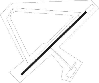
Runway info
| Runway 04 / 22 | ||
| length | 1055m (3461ft) | |
| bearing | 62° / 242° | |
| width | 23m (75ft) | |
| surface | asphalt | |
| blast zone | 6m (20ft) / 6m (20ft) | |
Nearby beacons
| code | identifier | dist | bearing | frequency |
|---|---|---|---|---|
| YBR | BRANDON VOR/DME | 25.6 | 233° | 113.80 |
| BR | BRANDON NDB | 29.1 | 240° | 233 |
| VLR | LANGRUTH VOR/DME | 32.2 | 76° | 112.20 |
| DN | DAUPHIN NDB | 56 | 328° | 224 |
| YDN | DAUPHIN VOR/DME | 56.3 | 328° | 116.10 |
Instrument approach procedures
| runway | airway (heading) | route (dist, bearing) |
|---|---|---|
| RW04 | SAVOD (30°) | SAVOD PIBVI (5mi, 308°) 2900ft |
| RW04 | UDKAP (84°) | UDKAP PIBVI (5mi, 128°) 2900ft |
| RNAV | PIBVI 2900ft MATUN (5mi, 62°) 2400ft CJV5 (4mi, 62°) 1327ft ADROP (5mi, 62°) 4300ft ADROP (turn) | |
| RW22 | TAKNA (264°) | TAKNA RODBA (5mi, 308°) 2500ft |
| RW22 | VIBLU (211°) | VIBLU RODBA (5mi, 128°) 2500ft |
| RNAV | RODBA 2500ft ODBEX (5mi, 242°) 2400ft CJV5 (4mi, 242°) 1324ft KESBO (5mi, 242°) 4300ft KESBO (turn) |
Disclaimer
The information on this website is not for real aviation. Use this data with the X-Plane flight simulator only! Data taken with kind consent from X-Plane 12 source code and data files. Content is subject to change without notice.