Rosetown
Airport details
| Country | Canada |
| State | Saskatchewan |
| Region | CY |
| Airspace | Winnipeg Ctr |
| Municipality | St. Andrews No. 287 |
| Elevation | 1918ft (585m) |
| Timezone | GMT -6 |
| Coordinates | 51.56445, -107.91833 |
| Magnetic var | |
| Type | land |
| Available since | X-Plane v10.40 |
| ICAO code | CJX4 |
| IATA code | n/a |
| FAA code | n/a |
Communication
| Rosetown ATC | 122.800 |
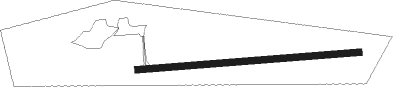
Runway info
| Runway 07 / 25 | ||
| length | 786m (2579ft) | |
| bearing | 90° / 270° | |
| width | 23m (75ft) | |
| surface | asphalt | |
Instrument approach procedures
| runway | airway (heading) | route (dist, bearing) |
|---|---|---|
| RW08 | LESIP (106°) | LESIP NADOM (5mi, 180°) 3600ft |
| RW08 | MIVUK (74°) | MIVUK NADOM (5mi, 360°) 3600ft |
| RNAV | NADOM 3600ft KITIR (6mi, 90°) 3600ft CJX4 (5mi, 90°) 1985ft OKUGU (7mi, 90°) 4200ft OKUGU (turn) | |
| RW26 | PUTAX (286°) | PUTAX SEKAT (5mi, 1°) 3600ft |
| RW26 | VIVAG (255°) | VIVAG SEKAT (5mi, 181°) 3600ft |
| RNAV | SEKAT 3600ft OTUTI (6mi, 270°) 3600ft CJX4 (5mi, 270°) 1982ft TAVPU (7mi, 270°) 4200ft TAVPU (turn) |
Disclaimer
The information on this website is not for real aviation. Use this data with the X-Plane flight simulator only! Data taken with kind consent from X-Plane 12 source code and data files. Content is subject to change without notice.