Springwater - Springwater Barrie Airpark
Airport details
| Country | Canada |
| State | Ontario |
| Region | CY |
| Airspace | Toronto Ctr |
| Municipality | Springwater |
| Elevation | 960ft (293m) |
| Timezone | GMT -5 |
| Coordinates | 44.40639, -79.73167 |
| Magnetic var | |
| Type | land |
| Available since | X-Plane v10.40 |
| ICAO code | CNA3 |
| IATA code | n/a |
| FAA code | n/a |
Communication
| Springwater Barrie Airpark CTAF/UNICOM | 123.000 |
Nearby Points of Interest:
The Briars
-Sutton radial station
-Orillia Railway Station
-Tremont House
-Collingwood Downtown Heritage Conservation District
-Queensville Radial Station
-Newmarket Railway Station
-Old Newmarket Town Hall and Courthouse
-St. James on-the-Lines
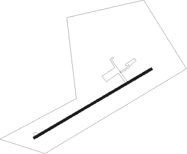
Runway info
| Runway 07 / 25 | ||
| length | 641m (2103ft) | |
| bearing | 71° / 251° | |
| width | 12m (40ft) | |
| surface | asphalt | |
| displ threshold | 31m (102ft) / 61m (200ft) | |
Nearby beacons
| code | identifier | dist | bearing | frequency |
|---|---|---|---|---|
| YEE | MIDLAND VOR/DME | 10.8 | 341° | 112.80 |
| YMS | MANS (MANSFIELD) VOR/DME | 23.8 | 238° | 114.50 |
| YSO | DME | 26 | 107° | 117.35 |
| KZ | BUTTONVILLE NDB | 33.3 | 140° | 248 |
| ZTO | WOODHILL (TORONTO) NDB | 40.1 | 178° | 403 |
| YTP | PEARSON (TORONTO) VOR/DME | 44.2 | 175° | 116.55 |
| YYZ | TORONTO VOR/DME | 45.1 | 172° | 112.15 |
| OO | OSHAWA NDB | 46.1 | 120° | 391 |
| YO | DME-ILS | 46.7 | 120° | 111.35 |
| ZYZ | QUEENSWAY (TORONTO) NDB | 47.9 | 167° | 368 |
| TZ | GIBRALTAR POINT NDB | 49.9 | 156° | 257 |
| ZKF | WELLINGTON (KITCHENER) NDB | 59.8 | 211° | 335 |
| WT | (KITCHENER) DME | 63.4 | 214° | 115 |
Disclaimer
The information on this website is not for real aviation. Use this data with the X-Plane flight simulator only! Data taken with kind consent from X-Plane 12 source code and data files. Content is subject to change without notice.