Collingwood
Airport details
| Country | Canada |
| State | Ontario |
| Region | CY |
| Airspace | Toronto Ctr |
| Municipality | Clearview |
| Elevation | 729ft (222m) |
| Timezone | GMT -5 |
| Coordinates | 44.44944, -80.15916 |
| Magnetic var | |
| Type | land |
| Available since | X-Plane v10.40 |
| ICAO code | CNY3 |
| IATA code | n/a |
| FAA code | n/a |
Communication
| Collingwood CTAF/UNICOM | 122.850 |
Nearby Points of Interest:
Collingwood Downtown Heritage Conservation District
-Tremont House
-St. James on-the-Lines
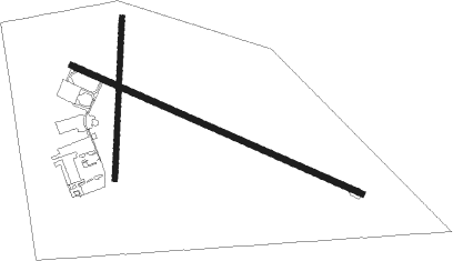
Runway info
Runway 13 / 31  | ||
| length | 1525m (5003ft) | |
| bearing | 111° / 291° | |
| width | 30m (100ft) | |
| surface | asphalt | |
| Runway 01 / 19 | ||
| length | 777m (2549ft) | |
| bearing | 10° / 190° | |
| width | 23m (75ft) | |
| surface | grass | |
| blast zone | 61m (200ft) / 0m (0ft) | |
Nearby beacons
| code | identifier | dist | bearing | frequency |
|---|---|---|---|---|
| YEE | MIDLAND VOR/DME | 17.5 | 70° | 112.80 |
| YMS | MANS (MANSFIELD) VOR/DME | 18.4 | 178° | 114.50 |
| YVV | WIARTON VOR/DME | 44.1 | 287° | 117.70 |
| YSO | DME | 44.2 | 102° | 117.35 |
| ZTO | WOODHILL (TORONTO) NDB | 46.9 | 147° | 403 |
| KZ | BUTTONVILLE NDB | 47.3 | 122° | 248 |
| YTP | PEARSON (TORONTO) VOR/DME | 51.3 | 148° | 116.55 |
| YYZ | TORONTO VOR/DME | 52.7 | 146° | 112.15 |
| ZYZ | QUEENSWAY (TORONTO) NDB | 56.4 | 144° | 368 |
| ZKF | WELLINGTON (KITCHENER) NDB | 57.7 | 188° | 335 |
| WT | (KITCHENER) DME | 60.2 | 193° | 115 |
| TZ | GIBRALTAR POINT NDB | 60.3 | 137° | 257 |
Instrument approach procedures
| runway | airway (heading) | route (dist, bearing) |
|---|---|---|
| RW13 | ESVOS (131°) | ESVOS URMER (5mi, 217°) 3000ft |
| RW13 | IPVOB (94°) | IPVOB URMER (5mi, 37°) 3000ft |
| RNAV | URMER 3000ft OTVUG (6mi, 111°) 2500ft CNY3 (6mi, 111°) 768ft NAKVA (3mi, 112°) PIKPU (6mi, 85°) 3100ft PIKPU (turn) 3100ft | |
| RW31 | KIRUB (283°) | KIRUB ONDUR (5mi, 269°) 3000ft |
| RNAV | ONDUR 3000ft MIXUR (5mi, 291°) 2100ft CNY3 (5mi, 292°) 780ft TULEB (6mi, 291°) 3100ft TULEB (turn) 3100ft |
Disclaimer
The information on this website is not for real aviation. Use this data with the X-Plane flight simulator only! Data taken with kind consent from X-Plane 12 source code and data files. Content is subject to change without notice.