Kars - Kars Rideau Valley Airpark
Airport details
| Country | Canada |
| State | Ontario |
| Region | CY |
| Airspace | Montreal Ctr |
| Municipality | Ottawa |
| Elevation | 286ft (87m) |
| Timezone | GMT -5 |
| Coordinates | 45.10000, -75.63333 |
| Magnetic var | |
| Type | land |
| Available since | X-Plane v10.40 |
| ICAO code | CPL3 |
| IATA code | n/a |
| FAA code | n/a |
Communication
| Kars Rideau Valley Airpark MF | 123.400 |
| Kars Rideau Valley Airpark Ottawa Terminal | 127.700 |
Nearby Points of Interest:
Kilmorie house
-Sir Charles Tupper Building
-Edward Drake Building
-K.W. Neatby Building
-Sir John Carling Building
-Main Building
-Ottawa Normal School
-Cartier Square Drill Hall
-Justice Building
-Wellington Building
-National Press Building
-Sir John A. Macdonald Building
-Confederation Building
-Supreme Court Building
-National Arts Centre
-Victoria Building
-Bell Block
-Scottish Ontario Chambers
-Confederation Square
-Senate of Canada Building
-fairmont chateau laurier gold experience
-Transportation Building
-Goodwin House
-Laurier House
-Fleck/Paterson House
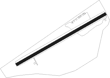
Runway info
| Runway 08 / 26 | ||
| length | 1084m (3556ft) | |
| bearing | 72° / 252° | |
| width | 30m (100ft) | |
| surface | grass | |
Nearby beacons
| code | identifier | dist | bearing | frequency |
|---|---|---|---|---|
| OW | OTTAWA NDB | 15.9 | 16° | 236 |
| YOW | OTTAWA VOR/DME | 23.3 | 322° | 114.60 |
| OG | OGIVE (OGDENSBURG) NDB | 26.7 | 145° | 358 |
| MS | MISSE (MASSENA) NDB | 33.8 | 109° | 278 |
| PTD | POTSDAM NDB | 39.1 | 117° | 400 |
| MSS | MASSENA TACAN | 40.2 | 102° | 114.10 |
| YGK | KINGSTON NDB | 63.6 | 230° | 263 |
Disclaimer
The information on this website is not for real aviation. Use this data with the X-Plane flight simulator only! Data taken with kind consent from X-Plane 12 source code and data files. Content is subject to change without notice.