Embrun - Embrun Airpark
Airport details
| Country | Canada |
| State | Ontario |
| Region | CY |
| Airspace | Montreal Ctr |
| Municipality | Russell |
| Elevation | 229ft (70m) |
| Timezone | GMT -5 |
| Coordinates | 45.24111, -75.29861 |
| Magnetic var | |
| Type | land |
| Available since | X-Plane v10.40 |
| ICAO code | CPR2 |
| IATA code | n/a |
| FAA code | n/a |
Communication
| Embrun Airpark ATF | 123.200 |
| Embrun Airpark Ottawa Terminal | 127.700 |
Nearby Points of Interest:
Petrie Island
-Edward Drake Building
-Sir Charles Tupper Building
-Masson railway station
-Fleck/Paterson House
-Goodwin House
-Laurier House
-Sir John Carling Building
-Cartier Square Drill Hall
-Ottawa Normal School
-Kilmorie house
-K.W. Neatby Building
-National Arts Centre
-Ste-Anne Church
-Senate of Canada Building
-Transportation Building
-Bell Block
-Scottish Ontario Chambers
-Confederation Square
-fairmont chateau laurier gold experience
-Sir John A. Macdonald Building
-Victoria Building
-National Press Building
-Wellington Building
-Crichton Street Public School
Runway info
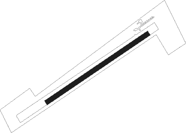
| Runway 08 / 26 | ||
| length | 764m (2507ft) | |
| bearing | 68° / 248° | |
| width | 29m (95ft) | |
| surface | grass | |
Nearby beacons
| code | identifier | dist | bearing | frequency |
|---|---|---|---|---|
| OW | OTTAWA NDB | 13.1 | 294° | 236 |
| YOW | OTTAWA VOR/DME | 27.9 | 289° | 114.60 |
| MS | MISSE (MASSENA) NDB | 28.3 | 135° | 278 |
| MSS | MASSENA TACAN | 31.3 | 120° | 114.10 |
| OG | OGIVE (OGDENSBURG) NDB | 32.4 | 186° | 358 |
| PTD | POTSDAM NDB | 35.7 | 141° | 400 |
| YMW | MANIWAKI NDB | 64.2 | 326° | 366 |
Disclaimer
The information on this website is not for real aviation. Use this data with the X-Plane flight simulator only! Data taken with kind consent from X-Plane 12 source code and data files. Content is subject to change without notice.