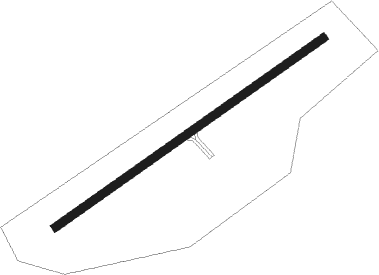
Airports for X-Plane offers a convenient way to explore airports and their related communication information for the X-Plane flight simulator. It only uses data from the X-Plane flight simulator itself, and is therefore more reliable than the data that comes from real aviation websites. You can search for airports by using the ICAO code, or browse for airports per country and state. The information displayed is categorized by airport details, runway information, airport communication, approach frequencies (ILS and Glidepath details), details of nearby beacons, SIDs, STARs and approach procedures.

taxi rail transport international metro southwest nearby passengers jet airliner international airport airdrome helipad asphalt warfare aerodromes customs corporation propeller plane rail seaplane

Montmagny

Airport details

CountryCanada
StateQuebec
RegionCY
AirspaceMontreal Ctr
MunicipalityCap-Saint-Ignace
Elevation32ft (10m)
TimezoneGMT -5
Coordinates47.00185, -70.51580
Magnetic var
Typeland
Available sinceX-Plane v10.40
ICAO codeCSE5
IATA coden/a
FAA coden/a

Communication

Montmagny CTAF/UNICOM122.700
Montmagny MONTREAL CTR 135.02128.800
Nearby Points of Interest:
Étienne-Paschal Taché House
-
Vincelotte Windmill
-
Grosse Isle, Quebec
-
Salle des habitants de L'Islet-sur-Mer
-
Chapelle des Marins (L'Islet)
-
Cap Tourmente National Wildlife Area
-
Maison Drouin
-
Mauvide-Genest Manor
-
Maison Morisset
-
Convent of the Redemptoristines
-
Sainte-Famille church
-
moulin de Beaumont
-
Site archéologique des Couvents-de-Château-Richer
-
Vieux couvent de Château-Richer
-
moulin à vent de L'Isle-aux-Coudres
-
Chapelle de procession de Saint-Gervais
-
Chapelle de procession Notre-Dame-de-Lourdes
-
Église de Saint-Pierre-de-l'Île-d'Orléans
-
Maison Leclerc (L'Isle-aux-Coudres)
-
Pont de Saint-Placide-de-Charlevoix
-
Maison Vézina

Runway info

Runway 08 / 26
 length915m (3002ft)
 bearing68° / 248°
 width23m (75ft)
 surfaceasphalt

Airport layout


Parking locations

Nearby beacons

codeidentifierdistbearingfrequency
BVCHAMPLAIN (QUEBEC) NDB32.3260°336
QBQUEBEC NDB41.7255°230
YRIRIVIERE DU LOUP VOR58.951°113.90
RIRIVIERE-DU-LOUP NDB59.551°201

Disclaimer

The information on this website is not for real aviation. Use this data with the X-Plane flight simulator only! Data taken with kind consent from X-Plane 12 source code and data files. Content is subject to change without notice.