Airports for X-Plane offers a convenient way to explore airports and their related communication information for the X-Plane flight simulator. It only uses data from the X-Plane flight simulator itself, and is therefore more reliable than the data that comes from real aviation websites. You can search for airports by using the ICAO code, or browse for airports per country and state. The information displayed is categorized by airport details, runway information, airport communication, approach frequencies (ILS and Glidepath details), details of nearby beacons, SIDs, STARs and approach procedures.

landing area rail train station stolport flown consulate terminal transit asphalt city field airplane southwest passengers airport airspace tarmac port stopover luggage

Ottawa - Casselman Shea Field

Airport details

CountryCanada
StateOntario
RegionCY
AirspaceMontreal Ctr
MunicipalityThe Nation
Elevation212ft (65m)
TimezoneGMT -5
Coordinates45.29972, -75.17139
Magnetic var
Typeland
Available sinceX-Plane v10.40
ICAO codeCSF7
IATA coden/a
FAA coden/a

Communication

Casselman Shea Field ATF123.200
Nearby Points of Interest:
Masson railway station
-
Petrie Island
-
Église Sainte-Angélique
-
Edward Drake Building
-
Sir Charles Tupper Building
-
Fleck/Paterson House
-
Laurier House
-
Goodwin House
-
Louis-Joseph-Papineau Funeral Chapel
-
Cartier Square Drill Hall
-
Ste-Anne Church
-
Ottawa Normal School
-
Crichton Street Public School
-
Rideau Cottage
-
National Arts Centre
-
Transportation Building
-
Senate of Canada Building
-
fairmont chateau laurier gold experience
-
Bell Block
-
Confederation Square
-
Scottish Ontario Chambers
-
Grange Pesant
-
Sir John Carling Building
-
Victoria Building
-
Sir John A. Macdonald Building

Runway info

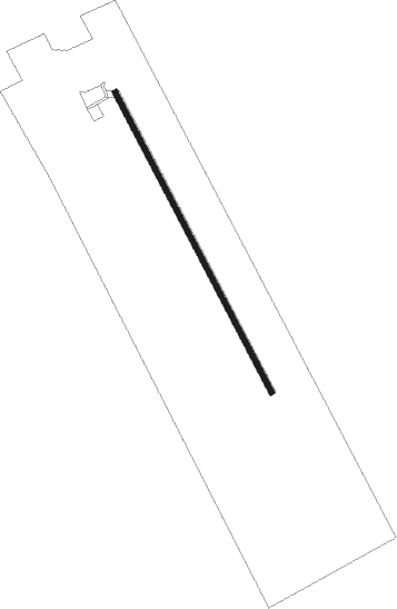
Runway 16 / 34
 length917m (3009ft)
 bearing149° / 329°
 width15m (50ft)
 surfacegrass

Airport layout


Nearby beacons

codeidentifierdistbearingfrequency
OWOTTAWA NDB16.8279°236
MSMISSE (MASSENA) NDB28.8150°278
MSSMASSENA TACAN29.9131°114.10
YOWOTTAWA VOR/DME31.7281°114.60
OGOGIVE (OGDENSBURG) NDB36.7197°358
PTDPOTSDAM NDB36.7153°400
ZMMJOLY (MONTREAL) NDB47.469°266
YMWMANIWAKI NDB63.6319°366
SLKLAKE DME68.6133°109.20

Disclaimer

The information on this website is not for real aviation. Use this data with the X-Plane flight simulator only! Data taken with kind consent from X-Plane 12 source code and data files. Content is subject to change without notice.