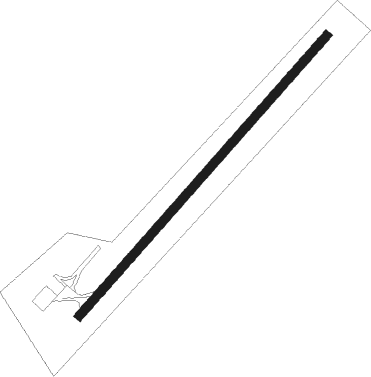
Thetford Mines
Airport details
| Country | Canada |
| State | Quebec |
| Region | CY |
| Airspace | Montreal Ctr |
| Municipality | Thetford Mines |
| Elevation | 1408ft (429m) |
| Timezone | GMT -5 |
| Coordinates | 46.05216, -71.25742 |
| Magnetic var | |
| Type | land |
| Available since | X-Plane v10.40 |
| ICAO code | CSM3 |
| IATA code | n/a |
| FAA code | n/a |
Communication
| Thetford Mines CTAF/UNICOM | 122.800 |
Runway info
| Runway 06 / 24 | ||
| length | 1373m (4505ft) | |
| bearing | 56° / 236° | |
| width | 30m (100ft) | |
| surface | asphalt | |
Nearby beacons
| code | identifier | dist | bearing | frequency |
|---|---|---|---|---|
| VLV | DME | 18.7 | 107° | 117.20 |
| YQB | QUEBEC VORTAC | 42 | 331° | 112.80 |
| QB | QUEBEC NDB | 42.7 | 344° | 230 |
| BV | CHAMPLAIN (QUEBEC) NDB | 49.1 | 358° | 336 |
| YSC | DME | 49.4 | 216° | 113.20 |
Instrument approach procedures
| runway | airway (heading) | route (dist, bearing) |
|---|---|---|
| RW06 | EBKUN (31°) | EBKUN OKOLU (6mi, 327°) 3100ft |
| RW06 | UKTIX (75°) | UKTIX OKOLU (5mi, 109°) 3100ft |
| RNAV | OKOLU 3100ft KIRUS (5mi, 56°) 3050ft DEDNA (3mi, 56°) 1968ft UKTIX (11mi, 258°) 4000ft UKTIX (turn) | |
| RW24 | PETPO (208°) | PETPO LOKMU (5mi, 221°) 4200ft |
| RNAV | LOKMU 4200ft EMAXI (5mi, 174°) 4140ft VERBU (3mi, 215°) 3190ft PESRI (3mi, 215°) 2390ft LISVI (3mi, 215°) 1585ft MUPRA (12mi, 215°) 4500ft MUPRA (turn) |
Disclaimer
The information on this website is not for real aviation. Use this data with the X-Plane flight simulator only! Data taken with kind consent from X-Plane 12 source code and data files. Content is subject to change without notice.
