Bagotville - Cfb Bagotville
Airport details
| Country | Canada |
| State | Quebec |
| Region | CY |
| Airspace | Montreal Ctr |
| Municipality | Ville de Saguenay |
| Elevation | 520ft (158m) |
| Timezone | GMT -5 |
| Coordinates | 48.33055, -70.99639 |
| Magnetic var | |
| Type | land |
| Available since | X-Plane v10.40 |
| ICAO code | CYBG |
| IATA code | YBG |
| FAA code | n/a |
Communication
| CFB Bagotville ATIS | 124.200 |
| CFB Bagotville Clearance DEL | 119.000 |
| CFB Bagotville Ground Control | 121.700 |
| CFB Bagotville Tower | 126.200 |
| CFB Bagotville TRML | 127.200 |
Approach frequencies
| ILS-cat-I | RW29 | 111.5 | 18.00mi |
| ILS-cat-I | RW11 | 110.15 | 18.00mi |
| 3° GS | RW29 | 111.5 | 18.00mi |
| 3° GS | RW11 | 110.15 | 18.00mi |
Nearby Points of Interest:
3883, chemin Saint-Joseph
-Église Notre-Dame-de-l'Immaculée-Conception
-Moulin du Père-Honorat
-Saint-François-Xavier Cathedral
-Maison Price
-Arvida Heritage Site
-Notre-Dame-de-Fatima Church
-Maison Jean-Maurice-Coulombe
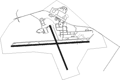
Runway info
Runway 11 / 29  | ||
| length | 3036m (9961ft) | |
| bearing | 91° / 271° | |
| width | 46m (150ft) | |
| surface | concrete | |
| blast zone | 55m (180ft) / 65m (213ft) | |
| Runway 18 / 36 | ||
| length | 1835m (6020ft) | |
| bearing | 155° / 335° | |
| width | 46m (150ft) | |
| surface | asphalt | |
| blast zone | 0m (0ft) / 2m (7ft) | |
Nearby beacons
| code | identifier | dist | bearing | frequency |
|---|---|---|---|---|
| XBG | BAGOTVILLE TACAN | 0 | 143° | 111.80 |
| YBG | BAGOTVILLE NDB | 5.9 | 271° | 356 |
| YRC | ST-HONORE NDB | 13.9 | 322° | 213 |
| VBS | SAGUENAY VOR/DME | 21.7 | 221° | 114.20 |
Instrument approach procedures
| runway | airway (heading) | route (dist, bearing) |
|---|---|---|
| RW11-X | KARAX (91°) | KARAX BIBOD (6mi, 91°) 2900ft |
| RW11-X | MEGEG (110°) | MEGEG BIBOD (6mi, 181°) 2900ft |
| RW11-X | PENLO (72°) | PENLO BIBOD (6mi, 1°) 2900ft |
| RNAV | BIBOD 2900ft URNIV (6mi, 91°) 2000ft CYBG (5mi, 91°) 568ft KAXOM (14mi, 91°) 4800ft KAXOM (turn) | |
| RW11-Y | KARAX (91°) | KARAX BIBOD (6mi, 91°) 3200ft |
| RW11-Y | MEGEG (110°) | MEGEG BIBOD (6mi, 181°) 3200ft |
| RW11-Y | VBS (41°) | VBS PENLO (13mi, 357°) 4000ft BIBOD (6mi, 1°) 3200ft |
| RNAV | BIBOD 3200ft URNIV (6mi, 91°) 2000ft URTEB (3mi, 91°) 1080ft CYBG (2mi, 92°) 571ft KAXOM (14mi, 91°) 4800ft KAXOM (turn) | |
| RW11-Z | KARAX (91°) | KARAX BIBOD (6mi, 91°) 2900ft |
| RW11-Z | MEGEG (110°) | MEGEG BIBOD (6mi, 181°) 2900ft |
| RW11-Z | PENLO (72°) | PENLO BIBOD (6mi, 1°) 2900ft |
| RNAV | BIBOD 2900ft URNIV (6mi, 91°) 2000ft CYBG (5mi, 91°) 568ft KAXOM (14mi, 91°) 4800ft KAXOM (turn) | |
| RW18 | IKDIM (156°) | IKDIM RODPA (5mi, 155°) 2400ft |
| RW18 | KATEM (194°) | KATEM RODPA (6mi, 258°) 2400ft |
| RW18 | LEVAR (126°) | LEVAR RODPA (6mi, 78°) 2400ft |
| RNAV | RODPA 2400ft PENSA (6mi, 155°) 2400ft CYBG (6mi, 157°) 570ft (4654mi, 124°) 1900ft KATEM (4655mi, 304°) 4800ft KATEM (turn) | |
| RW29-X | IPVIL (251°) | IPVIL NOXUG (6mi, 182°) 2600ft |
| RW29-X | ITNOP (271°) | ITNOP NOXUG (6mi, 271°) 2600ft |
| RW29-X | VOBUG (291°) | VOBUG NOXUG (6mi, 2°) 2600ft |
| RNAV | NOXUG 2600ft UMAKU (6mi, 271°) 1900ft CYBG (5mi, 270°) 566ft MUSAX (14mi, 271°) 4800ft MUSAX (turn) | |
| RW29-Y | IPVIL (251°) | IPVIL NOXUG (6mi, 182°) 3100ft |
| RW29-Y | ITNOP (271°) | ITNOP NOXUG (6mi, 271°) 3100ft |
| RW29-Y | VBS (41°) | VBS VOBUG (25mi, 69°) 4000ft NOXUG (6mi, 2°) 3100ft |
| RNAV | NOXUG 3100ft UMAKU (6mi, 271°) 1900ft CYBG (5mi, 270°) 566ft MUSAX (14mi, 271°) 4800ft MUSAX (turn) | |
| RW29-Z | IPVIL (251°) | IPVIL NOXUG (6mi, 182°) 2600ft |
| RW29-Z | ITNOP (271°) | ITNOP NOXUG (6mi, 271°) 2600ft |
| RW29-Z | VOBUG (291°) | VOBUG NOXUG (6mi, 2°) 2600ft |
| RNAV | NOXUG 2600ft UMAKU (6mi, 271°) 1900ft CYBG (5mi, 270°) 566ft MUSAX (14mi, 271°) 4800ft MUSAX (turn) | |
| RW36 | GOXIB (13°) | GOXIB IRKIR (6mi, 78°) 3300ft |
| RW36 | IGVEM (304°) | IGVEM IRKIR (6mi, 258°) 3300ft |
| RW36 | KEGNA (334°) | KEGNA IRKIR (5mi, 335°) 3300ft |
| RNAV | IRKIR 3300ft NOVUD (6mi, 335°) 2300ft KEDNU (3mi, 335°) 1340ft CYBG (3mi, 331°) 572ft (4654mi, 124°) 1900ft IGVEM (4643mi, 304°) 4800ft IGVEM (turn) |
Disclaimer
The information on this website is not for real aviation. Use this data with the X-Plane flight simulator only! Data taken with kind consent from X-Plane 12 source code and data files. Content is subject to change without notice.