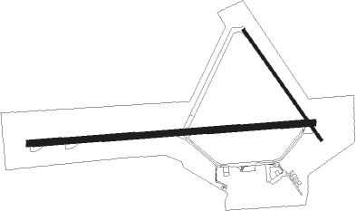
Brandon - Brandon Muni
Airport details
| Country | Canada |
| State | Manitoba |
| Region | CY |
| Airspace | Winnipeg Ctr |
| Municipality | Brandon |
| Elevation | 1338ft (408m) |
| Timezone | GMT -6 |
| Coordinates | 49.91000, -99.95227 |
| Magnetic var | |
| Type | land |
| Available since | X-Plane v10.40 |
| ICAO code | CYBR |
| IATA code | YBR |
| FAA code | YBR |
Communication
| Brandon Muni RDO | 122.100 |
Approach frequencies
| ILS-cat-I | RW08 | 110.1 | 18.00mi |
| 3° GS | RW08 | 110.1 | 18.00mi |
Nearby beacons
| code | identifier | dist | bearing | frequency |
|---|---|---|---|---|
| YBR | BRANDON VOR/DME | 0.2 | 91° | 113.80 |
| BR | BRANDON NDB | 4.6 | 269° | 233 |
Departure and arrival routes
| Transition altitude | 18000ft |
| Transition level | 18000ft |
| SID end points | distance | outbound heading | |
|---|---|---|---|
| RW08 | |||
| TUGIL1 | 19mi | 82° | |
| RW26 | |||
| UKMON1 | 19mi | 82° | |
| STAR starting points | distance | inbound heading | |
|---|---|---|---|
| RW08 | |||
| TALOP2 | 19.3 | 261° | |
| RW26 | |||
| TALOP2 | 19.3 | 261° | |
Instrument approach procedures
| runway | airway (heading) | route (dist, bearing) |
|---|---|---|
| RW08-Y | KAXEG (90°) | KAXEG 3000ft UKMON (6mi, 90°) 2700ft |
| RW08-Y | OMEBI (159°) | OMEBI 6000ft KITAR (3mi, 270°) 5000ft UKMON (5mi, 180°) 2700ft |
| RNAV | UKMON 2700ft CYBR (5mi, 89°) 1399ft TUGIL (5mi, 91°) 3000ft TUGIL (turn) | |
| RW08-Z | NUDUT (107°) | NUDUT 3000ft KAXEG (5mi, 180°) 3000ft |
| RW08-Z | TUBIV (73°) | TUBIV KAXEG (5mi, 0°) 3000ft |
| RNAV | KAXEG 3000ft UKMON (6mi, 90°) 2700ft CYBR (5mi, 89°) 1399ft TUGIL (5mi, 91°) 3000ft TUGIL (turn) | |
| RW26-Y | ILUSU (207°) | ILUSU 6000ft RIDIL (3mi, 99°) 5000ft TUGIL (5mi, 191°) 2700ft |
| RW26-Y | TANBA (271°) | TANBA 3000ft TUGIL (6mi, 270°) 2700ft |
| RNAV | TUGIL 2700ft CYBR (5mi, 271°) 1382ft UKMON (5mi, 269°) 3000ft UKMON (turn) | |
| RW26-Z | SAXIG (254°) | SAXIG TANBA (5mi, 181°) 3000ft |
| RNAV | TANBA 3000ft TUGIL (6mi, 270°) 2700ft CYBR (5mi, 271°) 1382ft UKMON (5mi, 269°) 3000ft UKMON (turn) |
Disclaimer
The information on this website is not for real aviation. Use this data with the X-Plane flight simulator only! Data taken with kind consent from X-Plane 12 source code and data files. Content is subject to change without notice.

