Miramichi
Airport details
| Country | Canada |
| State | New Brunswick |
| Region | CY |
| Airspace | Moncton Ctr |
| Municipality | Miramichi |
| Elevation | 106ft (32m) |
| Timezone | GMT -4 |
| Coordinates | 47.00579, -65.45680 |
| Magnetic var | |
| Type | land |
| Available since | X-Plane v10.40 |
| ICAO code | CYCH |
| IATA code | YCH |
| FAA code | n/a |
Communication
| MIRAMICHI CTAF/UNICOM | 122.700 |
Nearby Points of Interest:
Seaman's Hospital
-Beaubears Island
-The Enclosure Provincial Park
-Escuminac Disaster Memorial
-Sint-Lodewijkscollege
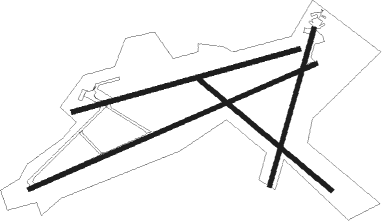
Runway info
Runway 10 / 28  | ||
| length | 2274m (7461ft) | |
| bearing | 82° / 262° | |
| width | 46m (150ft) | |
| surface | asphalt | |
| Runway 09 / 27 | ||
| length | 3037m (9964ft) | |
| bearing | 77° / 257° | |
| width | 46m (150ft) | |
| surface | asphalt | |
| Runway 15 / 33 | ||
| length | 1679m (5509ft) | |
| bearing | 124° / 304° | |
| width | 46m (150ft) | |
| surface | asphalt | |
| Runway 04 / 22 | ||
| length | 1581m (5187ft) | |
| bearing | 28° / 208° | |
| width | 46m (150ft) | |
| surface | asphalt | |
Nearby beacons
| code | identifier | dist | bearing | frequency |
|---|---|---|---|---|
| F9 | MIRAMICHI NDB | 0.5 | 291° | 520 |
| 1F | BATHURST NDB | 39.3 | 335° | 363 |
| ZMN | LEWISVILLE (MONCTON) NDB | 60.7 | 144° | 366 |
| YQM | MONCTON VOR/DME | 61.1 | 133° | 117.30 |
| ZQM | RIVERVIEW (MONCTON) NDB | 64.4 | 145° | 304 |
| QM | MONCTON NDB | 64.7 | 136° | 224 |
Instrument approach procedures
| runway | airway (heading) | route (dist, bearing) |
|---|---|---|
| RW09 | KAPAM (57°) | KAPAM SEKIP (6mi, 333°) 1800ft |
| RW09 | LETUP (94°) | LETUP SEKIP (6mi, 153°) 1800ft |
| RNAV | SEKIP 1800ft OBNOG (6mi, 77°) 1800ft CYCH (6mi, 77°) 160ft PIGDI (4mi, 77°) 2000ft PIGDI (turn) | |
| RW27 | TIGAV (237°) | TIGAV SASOV (6mi, 153°) 1800ft |
| RW27 | UBTOM (274°) | UBTOM SASOV (6mi, 333°) 1800ft |
| RNAV | SASOV 1800ft REVEG (6mi, 257°) 1800ft CYCH (6mi, 257°) 135ft EBDAV (4mi, 257°) 2000ft EBDAV (turn) |
Disclaimer
The information on this website is not for real aviation. Use this data with the X-Plane flight simulator only! Data taken with kind consent from X-Plane 12 source code and data files. Content is subject to change without notice.