Blue River
Airport details
| Country | Canada |
| State | British Columbia |
| Region | CY |
| Airspace | Vancouver Ctr |
| Municipality | Area B (Thompson Headwaters) |
| Elevation | 2265ft (690m) |
| Timezone | GMT -8 |
| Coordinates | 52.12476, -119.29283 |
| Magnetic var | |
| Type | land |
| Available since | X-Plane v10.40 |
| ICAO code | CYCP |
| IATA code | YCP |
| FAA code | YCP |
Communication
| Blue River Traffic | 123.200 |
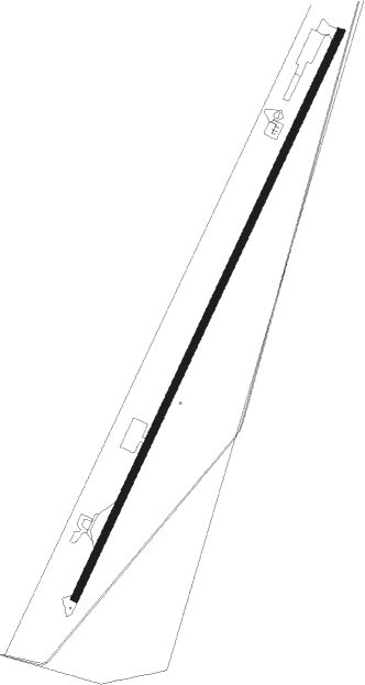
Runway info
| Runway 01 / 19 | ||
| length | 1546m (5072ft) | |
| bearing | 43° / 223° | |
| width | 18m (60ft) | |
| surface | asphalt | |
Instrument approach procedures
| runway | airway (heading) | route (dist, bearing) |
|---|---|---|
| RWNVA | FLOON (52°) | FLOON KODAP (61mi, 58°) 10700ft TABVA (10mi, 38°) 7300ft |
| RNAV | TABVA 7300ft IKMOP (4mi, 38°) 6600ft EBNAK (3mi, 22°) 6540ft OMPUM (3mi, 22°) 6480ft VOBEK (3mi, 22°) 6420ft OMPUK (27mi, 32°) 11400ft OMPUK (turn) | |
| RWNVB | FLOON (52°) | FLOON KODAP (61mi, 58°) 10700ft TABVA (10mi, 38°) 7300ft |
| RNAV | TABVA 7300ft IKMOP (4mi, 38°) 6600ft EBNAK (3mi, 22°) 6540ft OMPUM (3mi, 22°) 5500ft VOBEK (3mi, 22°) 4740ft OMPUK (27mi, 32°) 12200ft OMPUK (turn) |
Disclaimer
The information on this website is not for real aviation. Use this data with the X-Plane flight simulator only! Data taken with kind consent from X-Plane 12 source code and data files. Content is subject to change without notice.