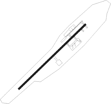
Dawson City
Airport details
| Country | Canada |
| State | Yukon |
| Region | CY |
| Airspace | Edmonton Ctr |
| Elevation | 1212ft (369m) |
| Timezone | GMT -8 |
| Coordinates | 64.04575, -139.12349 |
| Magnetic var | |
| Type | land |
| Available since | X-Plane v10.40 |
| ICAO code | CYDA |
| IATA code | YDA |
| FAA code | n/a |
Communication
Nearby beacons
| code | identifier | dist | bearing | frequency |
|---|---|---|---|---|
| DA | DAWSON CITY NDB | 1.5 | 249° | 214 |
Instrument approach procedures
| runway | airway (heading) | route (dist, bearing) |
|---|---|---|
| RW03-Y | KITIM (88°) | KITIM SUTSO (5mi, 140°) 4700ft |
| RW03-Y | PENBO (70°) | PENBO SUTSO (5mi, 320°) 5100ft |
| RNAV | SUTSO 4700ft GOTAB (6mi, 81°) 4700ft XONGO (3mi, 81°) 3400ft GOXIV (turn) 3080ft BUBEK (5mi, 81°) 1254ft MIXAD (5mi, 81°) 5300ft MIXAD (turn) | |
| RW03-Z | DUSUN (93°) | DUSUN MOBIB (5mi, 158°) 5100ft |
| RW03-Z | KEKVI (75°) | KEKVI MOBIB (5mi, 338°) 5100ft |
| RNAV | MOBIB 5100ft PIKDA (5mi, 86°) 4560ft XONTO (2mi, 86°) 3870ft IKMOX (3mi, 86°) 2820ft VINRU (4mi, 86°) 1254ft TIGED (5mi, 86°) 5600ft TIGED (turn) | |
| RW21 | DURUK (247°) | DURUK RUBTO (3mi, 247°) 7000ft PESRA (turn) 6600ft KAXAV (2mi, 247°) 5700ft VIVAB (2mi, 247°) 4500ft |
| RW21 | EBMUP (268°) | EBMUP VIVAB (8mi, 294°) 4500ft |
| RW21 | KEDLU (192°) | KEDLU DUXEX (3mi, 114°) 7000ft VIVAB (5mi, 114°) 4500ft |
| RNAV | VIVAB 4500ft LORPU (4mi, 247°) 3300ft CYDA (5mi, 247°) 1264ft (6566mi, 115°) 1620ft BUBAM (6575mi, 295°) 5500ft BUBAM (turn) |
Disclaimer
The information on this website is not for real aviation. Use this data with the X-Plane flight simulator only! Data taken with kind consent from X-Plane 12 source code and data files. Content is subject to change without notice.
