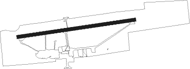
Dawson Creek
Airport details
| Country | Canada |
| State | British Columbia |
| Region | CY |
| Airspace | Edmonton Ctr |
| Municipality | Dawson Creek |
| Elevation | 2145ft (654m) |
| Timezone | GMT -7 |
| Coordinates | 55.74226, -120.18306 |
| Magnetic var | |
| Type | land |
| Available since | X-Plane v10.40 |
| ICAO code | CYDQ |
| IATA code | YDQ |
| FAA code | n/a |
Communication
| Dawson Creek AWOS | 128.550 |
| Dawson Creek MF PEACE RIVER RDO | 122.200 |
Nearby beacons
| code | identifier | dist | bearing | frequency |
|---|---|---|---|---|
| ZXJ | TAYLOR (FT ST JOHN) NDB | 30.7 | 314° | 246 |
| XJ | FORT SAINT JOHN NDB | 39.4 | 309° | 326 |
| YXJ | FORT SAINT JOHN VOR/DME | 40.3 | 307° | 114.20 |
Instrument approach procedures
| runway | airway (heading) | route (dist, bearing) |
|---|---|---|
| RW07-Y | PIKNU (101°) | PIKNU LENOP (6mi, 172°) 4400ft |
| RW07-Y | RIGAT (74°) | RIGAT LENOP (6mi, 353°) 4400ft |
| RNAV | LENOP 4400ft ALRAK (6mi, 88°) 4400ft CYDQ (7mi, 88°) 2186ft TABIX (7mi, 88°) 5100ft TABIX (turn) | |
| RW07-Z | PIKNU (101°) | PIKNU LENOP (6mi, 172°) 4400ft |
| RW07-Z | RIGAT (74°) | RIGAT LENOP (6mi, 353°) 4400ft |
| RNAV | LENOP 4400ft ALRAK (6mi, 88°) 4400ft OBSED (5mi, 88°) 3000ft CYDQ (3mi, 88°) 2186ft TABIX (7mi, 88°) 5100ft TABIX (turn) | |
| RW25 | DARAP (252°) | DARAP SAVAM (6mi, 174°) 4100ft |
| RW25 | UDNAV (283°) | UDNAV SAVAM (6mi, 354°) 4100ft |
| RNAV | SAVAM 4100ft MAROX (6mi, 268°) 4100ft ADSEG (2mi, 268°) 3260ft CYDQ (3mi, 268°) 2185ft (6393mi, 115°) 2800ft DEMGA (6401mi, 295°) 5100ft DEMGA (turn) |
Disclaimer
The information on this website is not for real aviation. Use this data with the X-Plane flight simulator only! Data taken with kind consent from X-Plane 12 source code and data files. Content is subject to change without notice.