Fort Albany
Airport details
| Country | Canada |
| State | Ontario |
| Region | CY |
| Airspace | Toronto Ctr |
| Municipality | Fort Albany |
| Elevation | 43ft (13m) |
| Timezone | GMT -5 |
| Coordinates | 52.20350, -81.69580 |
| Magnetic var | |
| Type | land |
| Available since | X-Plane v10.40 |
| ICAO code | CYFA |
| IATA code | YFA |
| FAA code | n/a |
Communication
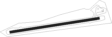
Runway info
| Runway 10 / 28 | ||
| length | 1099m (3606ft) | |
| bearing | 87° / 267° | |
| width | 30m (100ft) | |
| surface | gravel | |
Nearby beacons
| code | identifier | dist | bearing | frequency |
|---|---|---|---|---|
| YFA | FORT ALBANY NDB | 0.1 | 24° | 216 |
Instrument approach procedures
| runway | airway (heading) | route (dist, bearing) |
|---|---|---|
| RW10 | BOGDO (103°) | BOGDO AVADA (5mi, 173°) 1400ft |
| RW10 | UKPOS (70°) | UKPOS AVADA (5mi, 353°) 1400ft |
| RNAV | AVADA 1400ft DUGMU (6mi, 87°) 1400ft CYFA (4mi, 87°) 97ft IKDIK (5mi, 87°) 1300ft IKDIK (turn) | |
| RW28 | ILABU (251°) | ILABU NOPUP (5mi, 173°) 1400ft |
| RW28 | OMVET (284°) | OMVET NOPUP (5mi, 353°) 1400ft |
| RNAV | NOPUP 1400ft EBMAG (6mi, 267°) 1400ft CYFA (4mi, 267°) 95ft ULBOL (5mi, 267°) 1300ft ULBOL (turn) |
Disclaimer
The information on this website is not for real aviation. Use this data with the X-Plane flight simulator only! Data taken with kind consent from X-Plane 12 source code and data files. Content is subject to change without notice.