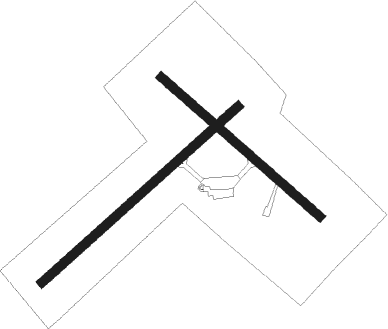
Îles-de-la-madeleine - Iles De La Madeleine
Airport details
| Country | Canada |
| State | Quebec |
| Region | CY |
| Airspace | Moncton Ctr |
| Municipality | Les Îles-de-la-Madeleine |
| Elevation | 35ft (11m) |
| Timezone | GMT -5 |
| Coordinates | 47.42507, -61.77798 |
| Magnetic var | |
| Type | land |
| Available since | X-Plane v10.40 |
| ICAO code | CYGR |
| IATA code | YGR |
| FAA code | n/a |
Communication
| ILES DE LA MADELEINE RADIO | 123.150 |
Approach frequencies
| LOC | RW07 | 109.9 | 18.00mi |
Nearby beacons
| code | identifier | dist | bearing | frequency |
|---|---|---|---|---|
| YGR | DME | 0.3 | 38° | 112 |
Instrument approach procedures
| runway | airway (heading) | route (dist, bearing) |
|---|---|---|
| RW07 | EBLOM (36°) | EBLOM DAVAK (5mi, 312°) 1500ft |
| RW07 | EMEGI (83°) | EMEGI DAVAK (5mi, 131°) 1500ft |
| RNAV | DAVAK 1500ft IMOPA (5mi, 62°) 1500ft XUGOM (2mi, 63°) 710ft CYGR (2mi, 63°) 72ft KESDO (5mi, 62°) 1900ft KESDO (turn) | |
| RW16 | DURAD (103°) | DURAD EPSAR (5mi, 56°) 1400ft |
| RW16 | URLOX (158°) | URLOX EPSAR (5mi, 236°) 1400ft |
| RNAV | EPSAR 1400ft RONGA (5mi, 125°) 1400ft CYGR (4mi, 127°) 59ft (4285mi, 128°) 1000ft EPSAR (4293mi, 308°) 1900ft EPSAR (turn) | |
| RW25 | BEITH (262°) | BEITH COLEJ (5mi, 312°) 1600ft |
| RW25 | BOJTO (216°) | BOJTO COLEJ (5mi, 132°) 1600ft |
| RNAV | COLEJ 1600ft NAPKU (5mi, 243°) 1600ft CYGR (5mi, 242°) 62ft IKBIP (5mi, 243°) 1900ft IKBIP (turn) | |
| RW34 | OLABO (284°) | OLABO PIKLI (5mi, 237°) 1700ft |
| RW34 | TIBIM (332°) | TIBIM PIKLI (5mi, 56°) 1700ft |
| RNAV | PIKLI 1700ft VETSU (6mi, 305°) 1400ft CYGR (5mi, 303°) 85ft UKODI (5mi, 307°) 1900ft UKODI (turn) |
Disclaimer
The information on this website is not for real aviation. Use this data with the X-Plane flight simulator only! Data taken with kind consent from X-Plane 12 source code and data files. Content is subject to change without notice.

