Nemiscau
Airport details
| Country | Canada |
| State | Quebec |
| Region | CY |
| Airspace | Montreal Ctr |
| Municipality | Eeyou Istchee James Bay |
| Elevation | 800ft (244m) |
| Timezone | GMT -5 |
| Coordinates | 51.69104, -76.13554 |
| Magnetic var | |
| Type | land |
| Available since | X-Plane v10.40 |
| ICAO code | CYHH |
| IATA code | YNS |
| FAA code | n/a |
Communication
| Nemiscau UNICOM | 131.700 |
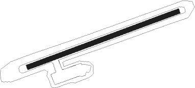
Runway info
| Runway 09 / 27 | ||
| length | 1529m (5016ft) | |
| bearing | 80° / 260° | |
| width | 46m (150ft) | |
| surface | gravel | |
Instrument approach procedures
| runway | airway (heading) | route (dist, bearing) |
|---|---|---|
| RW09-Y | KENVI (95°) | KENVI MIXID (5mi, 155°) 2400ft |
| RW09-Y | PILBA (62°) | PILBA MIXID (5mi, 335°) 2400ft |
| RNAV | MIXID 2400ft TEVUK (6mi, 80°) 2300ft CYHH (5mi, 80°) 852ft UDLAN (5mi, 80°) 3400ft UDLAN (turn) | |
| RW09-Z | KENVI (95°) | KENVI MIXID (5mi, 155°) 2400ft |
| RW09-Z | PILBA (62°) | PILBA MIXID (5mi, 335°) 2400ft |
| RNAV | MIXID 2400ft TEVUK (6mi, 80°) 2300ft CYHH (5mi, 80°) 852ft UDLAN (5mi, 80°) 3400ft UDLAN (turn) 3400ft | |
| RW27-Y | LISGI (242°) | LISGI SEGUK (5mi, 155°) 3400ft |
| RW27-Y | URVIV (275°) | URVIV SEGUK (5mi, 336°) 3400ft |
| RNAV | SEGUK 3400ft OTSEP (6mi, 260°) 2300ft XUBUL (2mi, 260°) 1570ft CYHH (3mi, 260°) 834ft ILIPA (5mi, 260°) 3400ft ILIPA (turn) | |
| RW27-Z | LISGI (242°) | LISGI SEGUK (5mi, 155°) 3400ft |
| RW27-Z | URVIV (275°) | URVIV SEGUK (5mi, 336°) 3400ft |
| RNAV | SEGUK 3400ft OTSEP (6mi, 260°) 2300ft XUBUL (2mi, 260°) 1570ft CYHH (3mi, 260°) 834ft ILIPA (5mi, 260°) 3400ft ILIPA (turn) 3400ft |
Disclaimer
The information on this website is not for real aviation. Use this data with the X-Plane flight simulator only! Data taken with kind consent from X-Plane 12 source code and data files. Content is subject to change without notice.