Montréal - St Hubert
Airport details
| Country | Canada |
| State | Quebec |
| Region | CY |
| Airspace | Montreal Ctr |
| Municipality | Longueuil |
| Elevation | 87ft (27m) |
| Timezone | GMT -5 |
| Coordinates | 45.51334, -73.41071 |
| Magnetic var | |
| Type | land |
| Available since | X-Plane v10.40 |
| ICAO code | CYHU |
| IATA code | YHU |
| FAA code | n/a |
Communication
| St Hubert ATIS | 124.900 |
| St Hubert Ground Control | 126.400 |
| St Hubert Tower | 118.400 |
Approach frequencies
| ILS-cat-I | RW24R | 111.1 | 18.00mi |
| 3° GS | RW24R | 111.1 | 18.00mi |
Nearby Points of Interest:
Église Saint-Bruno-de-Montarville
-Fort Longueuil
-Old Longueuil
-Caserne Létourneux
-Habitat 67
-Pied-du-Courant Prison
-Louis-Joseph Papineau National Historic Site
-Maison Cartier
-édifice Jacques-Viger
-Maison Brossard-Gauvin
-Complexe Chaussegros-de-Léry
-Montreal City Hall
-Édifice Ernest-Cormier
-Pointe-à-Callière
-Gilles-Hocquart Building
-Lucien Saulnier Building
-Grey Nuns' Hospital
-Place D'Youville
-St. Ann's Market
-Banque du Peuple
-500 Place D'Armes
-Molson Bank Building, Montreal
-Canada Life Building
-Wilson Chambers Building
-Bibliothèque et Archives nationales du Québec
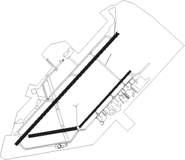
Runway info
Runway 06L / 24R  | ||
| length | 2374m (7789ft) | |
| bearing | 57° / 237° | |
| width | 46m (150ft) | |
| surface | asphalt | |
| displ threshold | 336m (1102ft) / 0m (0ft) | |
| blast zone | 0m (0ft) / 30m (98ft) | |
| Runway 06R / 24L | ||
| length | 1190m (3904ft) | |
| bearing | 57° / 237° | |
| width | 30m (100ft) | |
| surface | asphalt | |
| Runway 10 / 28 | ||
| length | 733m (2405ft) | |
| bearing | 86° / 266° | |
| width | 46m (150ft) | |
| surface | asphalt | |
| blast zone | 114m (374ft) / 0m (0ft) | |
Nearby beacons
| code | identifier | dist | bearing | frequency |
|---|---|---|---|---|
| ZHU | HAUTS-BOIS (MONTREAL) NDB | 4 | 51° | 407 |
| YJN | DME | 15.9 | 161° | 115.80 |
| YUL | MONTREAL VOR/DME | 24.3 | 280° | 116.30 |
| ZMX | JANVIER (MONTREAL) NDB | 25.4 | 294° | 317 |
| ZMR | HERMAS (MONTREAL) NDB | 29.2 | 279° | 272 |
| ZMM | JOLY (MONTREAL) NDB | 34 | 282° | 266 |
| BT | HERRO (BURLINGTON) NDB | 59.3 | 171° | 382 |
| YRQ | TROIS-RIVIERES NDB | 60.1 | 41° | 205 |
Departure and arrival routes
| Transition altitude | 18000ft |
| Transition level | 18000ft |
| SID end points | distance | outbound heading | |
|---|---|---|---|
| RW06 (ALL) | |||
| CYHU7 | 30mi | 283° | |
| RW24 (ALL) | |||
| CYHU7 | 30mi | 283° | |
| RW28 | |||
| CYHU7 | 30mi | 283° | |
Instrument approach procedures
| runway | airway (heading) | route (dist, bearing) |
|---|---|---|
| RW06L | ILEGU (77°) | ILEGU MUXIL (4mi, 102°) 3000ft LOBDO (5mi, 91°) 3000ft |
| RW06L | PIDRI (31°) | PIDRI LOBDO (5mi, 307°) 3000ft |
| RW06L | SUTAV (45°) | SUTAV LOBDO (5mi, 12°) 3000ft |
| RNAV | LOBDO 3000ft OTOLA (6mi, 57°) 1400ft CYHU (4mi, 61°) 138ft (4712mi, 122°) 2000ft VEVSU (4705mi, 302°) 3000ft VEVSU (turn) 3000ft | |
| RW06R | ILEGU (77°) | ILEGU MUXIL (4mi, 102°) 3000ft KETVU (5mi, 92°) 3000ft |
| RW06R | PIDRI (31°) | PIDRI KETVU (5mi, 307°) 3000ft |
| RW06R | SUTAV (45°) | SUTAV KETVU (5mi, 15°) 3000ft |
| RNAV | KETVU 3000ft ODGUR (6mi, 57°) 1400ft CYHU (4mi, 58°) 133ft (4712mi, 122°) 2000ft VEVSU (4705mi, 302°) 3000ft VEVSU (turn) | |
| RW24L | ITNID (256°) | ITNID MOBEP (5mi, 307°) 3000ft |
| RW24L | LIRTI (207°) | LIRTI MOBEP (5mi, 127°) 3000ft |
| RW24L | MAIRE (236°) | MAIRE MOBEP (6mi, 235°) 3000ft |
| RNAV | MOBEP 3000ft XIDAD (3mi, 237°) 2420ft MIPEL (3mi, 237°) 1500ft XESEN (1mi, 237°) 1130ft CYHU (4mi, 235°) 138ft (4712mi, 122°) 2000ft VEVSU (4705mi, 302°) 2000ft VEVSU (turn) | |
| RW24R | ITNID (256°) | ITNID EPVIT (5mi, 307°) 3000ft |
| RW24R | LIRTI (207°) | LIRTI EPVIT (5mi, 127°) 3000ft |
| RW24R | MAIRE (236°) | MAIRE EPVIT (6mi, 238°) 3000ft |
| RNAV | EPVIT 3000ft XUKLU (3mi, 237°) 2390ft MEGDO (3mi, 237°) 1500ft XORVI (1mi, 237°) 1130ft CYHU (4mi, 231°) 139ft (4712mi, 122°) 2000ft VEVSU (4705mi, 302°) 2000ft VEVSU (turn) 2000ft |
Disclaimer
The information on this website is not for real aviation. Use this data with the X-Plane flight simulator only! Data taken with kind consent from X-Plane 12 source code and data files. Content is subject to change without notice.