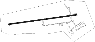
Barrie-orillia - Lake Simcoe Regl
Airport details
| Country | Canada |
| State | Ontario |
| Region | CY |
| Airspace | Toronto Ctr |
| Municipality | Oro-Medonte |
| Elevation | 972ft (296m) |
| Timezone | GMT -5 |
| Coordinates | 44.48603, -79.55563 |
| Magnetic var | |
| Type | land |
| Available since | X-Plane v10.40 |
| ICAO code | CYLS |
| IATA code | YLK |
| FAA code | n/a |
Communication
| Lake Simcoe Regl AWOS | 122.550 |
| Lake Simcoe Regl ATF | 122.700 |
Nearby Points of Interest:
Orillia Railway Station
-The Briars
-Sutton radial station
-Canal Lake Concrete Arch Bridge
-Queensville Radial Station
-St. James on-the-Lines
-Newmarket Railway Station
-Old Newmarket Town Hall and Courthouse
-Gravenhurst Railway Station
-Tremont House
-Collingwood Downtown Heritage Conservation District
Nearby beacons
| code | identifier | dist | bearing | frequency |
|---|---|---|---|---|
| YEE | MIDLAND VOR/DME | 11.6 | 292° | 112.80 |
| YSO | DME | 22.2 | 123° | 117.35 |
| YMS | MANS (MANSFIELD) VOR/DME | 32.6 | 240° | 114.50 |
| KZ | BUTTONVILLE NDB | 34.6 | 158° | 248 |
| OO | OSHAWA NDB | 44.1 | 131° | 391 |
| YO | DME-ILS | 44.6 | 130° | 111.35 |
| ZTO | WOODHILL (TORONTO) NDB | 45.3 | 191° | 403 |
| YTP | PEARSON (TORONTO) VOR/DME | 49.1 | 188° | 116.55 |
| YYZ | TORONTO VOR/DME | 49.8 | 185° | 112.15 |
| ZYZ | QUEENSWAY (TORONTO) NDB | 52 | 179° | 368 |
| TZ | GIBRALTAR POINT NDB | 52.9 | 169° | 257 |
| ZKF | WELLINGTON (KITCHENER) NDB | 67.4 | 216° | 335 |
Instrument approach procedures
| runway | airway (heading) | route (dist, bearing) |
|---|---|---|
| RW10-Y | MURON (67°) | MURON UMEDI (6mi, 355°) 2700ft |
| RW10-Y | NOXOR (107°) | NOXOR UMEDI (6mi, 175°) 2700ft |
| RNAV | UMEDI 2700ft OBVEG (6mi, 87°) 2700ft DAPEV (2mi, 87°) 2030ft CYLS (4mi, 87°) 1022ft LEVIP (6mi, 87°) 3000ft LEVIP (turn) | |
| RW10-Z | MURON (67°) | MURON UMEDI (6mi, 355°) 2700ft |
| RW10-Z | NOXOR (107°) | NOXOR UMEDI (6mi, 175°) 2700ft |
| RNAV | UMEDI 2700ft OBVEG (6mi, 87°) 2700ft DAPEV (2mi, 87°) 2030ft CYLS (4mi, 87°) 1022ft LEVIP (6mi, 87°) 3000ft LEVIP (turn) | |
| RW28 | MURVO (247°) | MURVO ULINO (6mi, 175°) 2700ft |
| RW28 | NUGUL (287°) | NUGUL ULINO (6mi, 355°) 2700ft |
| RNAV | ULINO 2700ft ODKIK (6mi, 268°) 2700ft CYLS (6mi, 267°) 1005ft PIDKA (7mi, 267°) 3000ft PIDKA (turn) |
Disclaimer
The information on this website is not for real aviation. Use this data with the X-Plane flight simulator only! Data taken with kind consent from X-Plane 12 source code and data files. Content is subject to change without notice.