Air Vice Marshall C.m. Mcewan
Airport details
| Country | Canada |
| State | Saskatchewan |
| Region | CY |
| Airspace | Winnipeg Ctr |
| Municipality | Moose Jaw No. 161 |
| Elevation | 1873ft (571m) |
| Timezone | GMT -6 |
| Coordinates | 50.33028, -105.55917 |
| Magnetic var | |
| Type | land |
| Available since | X-Plane v10.30 |
| ICAO code | CYMJ |
| IATA code | YMJ |
| FAA code | n/a |
Communication
| Air Vice Marshall C.M. McEwan ATIS CYMJ | 257.800 |
| Air Vice Marshall C.M. McEwan Clearance DEL | 135.300 |
| Air Vice Marshall C.M. McEwan GROUND CYMJ | 121.800 |
| Air Vice Marshall C.M. McEwan TOWER CYMJ | 126.200 |
| Air Vice Marshall C.M. McEwan DepartureART CYMJ | 119.000 |
Approach frequencies
| ILS-cat-I | RW11L | 109.3 | 18.00mi |
| ILS-cat-I | RW29R | 109.3 | 18.00mi |
| 3° GS | RW11L | 109.3 | 18.00mi |
| 3° GS | RW29R | 109.3 | 18.00mi |
Nearby Points of Interest:
Moose Jaw Canadian Pacific Railway Station
-Moose Jaw City Hall
-Land Titles Building
-Moose Jaw Canadian National Railway Station
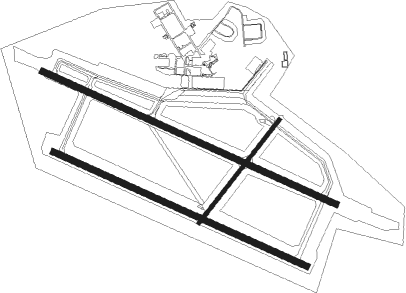
Runway info
Runway 03 / 21  | ||
| length | 1046m (3432ft) | |
| bearing | 55° / 235° | |
| width | 31m (101ft) | |
| surface | asphalt | |
| Runway 11R / 29L | ||
| length | 2219m (7280ft) | |
| bearing | 109° / 289° | |
| width | 47m (155ft) | |
| surface | concrete | |
| Runway 11L / 29R | ||
| length | 2571m (8435ft) | |
| bearing | 109° / 289° | |
| width | 47m (155ft) | |
| surface | concrete | |
Nearby beacons
| code | identifier | dist | bearing | frequency |
|---|---|---|---|---|
| YMJ | MOOSE JAW VORTAC | 0.1 | 281° | 113.40 |
| VLN | LUMSDEN VORTAC | 32.6 | 63° | 114.20 |
| ZRS | AJAX (REGINA) NDB | 32.8 | 79° | 219 |
| QR | REGINA NDB | 37.8 | 88° | 290 |
| NI | ASSINIBOIA NDB | 39.1 | 213° | 278 |
Instrument approach procedures
| runway | airway (heading) | route (dist, bearing) |
|---|---|---|
| RW11L | BESEN (109°) | BESEN 4000ft |
| RW11L | DUKPI (133°) | DUKPI BESEN (6mi, 220°) 4000ft |
| RW11L | EBLEP (92°) | EBLEP BESEN (6mi, 40°) 4000ft |
| RNAV | BESEN 4000ft NADAG (6mi, 109°) 3600ft CYMJ (6mi, 110°) 1935ft ALPEL (15mi, 108°) 5000ft ALPEL (turn) | |
| RW29R | IGTOL (289°) | IGTOL 4000ft |
| RW29R | IPRUN (271°) | IPRUN IGTOL (6mi, 221°) 4000ft |
| RW29R | LIDAN (313°) | LIDAN IGTOL (6mi, 40°) 4000ft |
| RNAV | IGTOL 4000ft GOXAG (7mi, 289°) 3400ft CYMJ (5mi, 288°) 1934ft IGSAG (15mi, 292°) 5000ft IGSAG (turn) |
Disclaimer
The information on this website is not for real aviation. Use this data with the X-Plane flight simulator only! Data taken with kind consent from X-Plane 12 source code and data files. Content is subject to change without notice.