Gatineau - Ottawa/gatineau
Airport details
| Country | Canada |
| State | Quebec |
| Region | CY |
| Airspace | Montreal Ctr |
| Municipality | Gatineau |
| Elevation | 208ft (63m) |
| Timezone | GMT -5 |
| Coordinates | 45.52169, -75.56361 |
| Magnetic var | |
| Type | land |
| Available since | X-Plane v10.40 |
| ICAO code | CYND |
| IATA code | YND |
| FAA code | n/a |
Communication
| Ottawa/Gatineau CTAF | 122.300 |
| Ottawa/Gatineau MF | 122.300 |
| Ottawa/Gatineau OTTAWA TRML | 128.175 |
| Ottawa/Gatineau VFR ADVSY | 127.700 |
| Ottawa/Gatineau OTTAWA TRML | 127.700 |
Nearby Points of Interest:
Petrie Island
-Masson railway station
-Rideau Cottage
-Crichton Street Public School
-7 Rideau Gate
-Fleck/Paterson House
-Ste-Anne Church
-John G. Diefenbaker Building
-Laurier House
-Goodwin House
-Lester B. Pearson Building
-Transportation Building
-Senate of Canada Building
-Cartier Square Drill Hall
-fairmont chateau laurier gold experience
-National Arts Centre
-Confederation Square
-Bell Block
-Scottish Ontario Chambers
-Ottawa Normal School
-caserne numéro 3
-Victoria Building
-Sir John A. Macdonald Building
-National Press Building
-Wellington Building
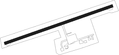
Runway info
| Runway 09 / 27 | ||
| length | 1822m (5978ft) | |
| bearing | 80° / 260° | |
| width | 46m (150ft) | |
| surface | asphalt | |
| blast zone | 61m (200ft) / 61m (200ft) | |
Nearby beacons
| code | identifier | dist | bearing | frequency |
|---|---|---|---|---|
| OW | OTTAWA NDB | 9.7 | 179° | 236 |
| YOW | OTTAWA VOR/DME | 14.8 | 257° | 114.60 |
| YMW | MANIWAKI NDB | 44.3 | 330° | 366 |
| MS | MISSE (MASSENA) NDB | 48.5 | 136° | 278 |
| OG | OGIVE (OGDENSBURG) NDB | 50 | 166° | 358 |
| MSS | MASSENA TACAN | 50.9 | 126° | 114.10 |
| PTD | POTSDAM NDB | 55.9 | 140° | 400 |
Departure and arrival routes
| Transition altitude | 18000ft |
| Transition level | 18000ft |
| SID end points | distance | outbound heading | |
|---|---|---|---|
| RW09 | |||
| CYND3 | 50mi | 84° | |
| RW27 | |||
| CYND3 | 50mi | 84° | |
Instrument approach procedures
| runway | airway (heading) | route (dist, bearing) |
|---|---|---|
| RW09 | DEDAR (80°) | DEDAR SPUZM (5mi, 79°) 2900ft |
| RW09 | EPSUX (99°) | EPSUX SPUZM (5mi, 159°) 2900ft |
| RNAV | SPUZM 2900ft IRKIN (5mi, 80°) 1500ft GOTIN (1mi, 80°) 1020ft CYND (3mi, 80°) 259ft APKOP (4mi, 80°) 3000ft APKOP (turn) | |
| RW27 | ESTEV (260°) | ESTEV AVRUR (5mi, 260°) 1900ft |
| RW27 | NUDAX (241°) | NUDAX AVRUR (5mi, 160°) 1900ft |
| RNAV | AVRUR 1900ft GOVEX (6mi, 260°) 1800ft AXOBA (3mi, 260°) 990ft CYND (3mi, 260°) 261ft DUVIL (7mi, 260°) 3000ft DUVIL (turn) |
Disclaimer
The information on this website is not for real aviation. Use this data with the X-Plane flight simulator only! Data taken with kind consent from X-Plane 12 source code and data files. Content is subject to change without notice.