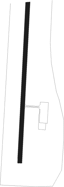
Fort Mackay - Horizon
Airport details
| Country | Canada |
| State | Alberta |
| Region | CY |
| Airspace | Edmonton Ctr |
| Municipality | Wood Buffalo |
| Elevation | 916ft (279m) |
| Timezone | GMT -7 |
| Coordinates | 57.38155, -111.70112 |
| Magnetic var | |
| Type | land |
| Available since | X-Plane v10.40 |
| ICAO code | CYNR |
| IATA code | HZP |
| FAA code | n/a |
Communication
| Horizon AWOS | 122.550 |
| Horizon Unicom | 122.700 |
| Horizon Horizon Traffic | 123.500 |
Nearby beacons
| code | identifier | dist | bearing | frequency |
|---|---|---|---|---|
| J4 | FORT MC MURRAY/CDC 87 NDB | 22.3 | 102° | 299 |
| 1L | FORT MACKAY/FIREBAG NDB | 24.3 | 98° | 400 |
| MM | FORT MC MURRAY NDB | 45.3 | 153° | 388 |
| YMM | FORT MCMURRAY VOR/DME | 47.9 | 142° | 112 |
Departure and arrival routes
| Transition altitude | 18000ft |
| Transition level | 18000ft |
| SID end points | distance | outbound heading | |
|---|---|---|---|
| RW17 | |||
| TAGIT3 | 19mi | 237° | |
| RW35 | |||
| TAGIT3 | 19mi | 237° | |
Instrument approach procedures
| runway | airway (heading) | route (dist, bearing) |
|---|---|---|
| RW17 | OMPAM (146°) | OMPAM KAVOM (6mi, 94°) 3300ft |
| RW17 | TULAG (280°) | TULAG RIDOX (119mi, 284°) 3400ft DUPAT (10mi, 282°) 3300ft KAVOM (5mi, 274°) 3300ft |
| RNAV | KAVOM 3300ft IGTIN (6mi, 194°) 2600ft CYNR (6mi, 194°) 961ft VIBTI (5mi, 194°) 4000ft VIBTI (turn) | |
| RW35 | OMVAT (47°) | OMVAT KEDMO (5mi, 94°) 2700ft |
| RW35 | SEKIK (26°) | SEKIK KEDMO (17mi, 33°) 2700ft |
| RW35 | TULAG (280°) | TULAG DUXEB (117mi, 277°) 3600ft SUSUG (8mi, 276°) 2700ft KEDMO (5mi, 274°) 2700ft |
| RNAV | KEDMO 2700ft IKDER (6mi, 13°) 2700ft DUNUK (4mi, 14°) 1520ft CYNR (2mi, 14°) 963ft VIGPA (5mi, 14°) 4000ft VIGPA (turn) |
Disclaimer
The information on this website is not for real aviation. Use this data with the X-Plane flight simulator only! Data taken with kind consent from X-Plane 12 source code and data files. Content is subject to change without notice.
