Oshawa
Airport details
| Country | Canada |
| State | Ontario |
| Region | CY |
| Airspace | Toronto Ctr |
| Municipality | Oshawa |
| Elevation | 458ft (140m) |
| Timezone | GMT -5 |
| Coordinates | 43.92283, -78.89674 |
| Magnetic var | |
| Type | land |
| Available since | X-Plane v10.40 |
| ICAO code | CYOO |
| IATA code | YOO |
| FAA code | n/a |
Communication
| Oshawa ATIS | 125.675 |
| Oshawa Ground Control | 118.400 |
| Oshawa Tower | 120.100 |
| Oshawa TORONTO TRML | 133.400 |
| Oshawa Departure | 133.400 |
Nearby Points of Interest:
Whitby Junction station
-Cream of Barley Mill
-Bead Hill archaeological site
-Uxbridge railway station
-Lebovic Centre for Arts & Entertainment – Nineteen on the Park
-Markham Village Town Hall
-Taber Hill
-Markham Civic Centre
-Richmond Hill railway station
-George Davis House
-David Dunlap Observatory
-Dr. William D. Young Memorial
-Roxy Theatre
-Ashbridge Estate
-Government of Canada Building
-John Cox Cottage
-Old Newmarket Town Hall and Courthouse
-Don Brewery
-George Manning Furby House
-Newmarket Railway Station
-James Cooper House
-Deer Park United Church
-Masonic Temple
-Walnut Hall
-Maple Leaf Gardens
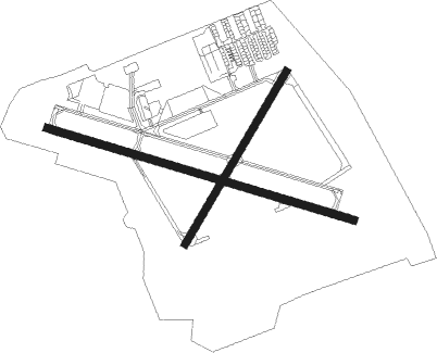
Runway info
Runway 12 / 30  | ||
| length | 1291m (4236ft) | |
| bearing | 106° / 286° | |
| width | 30m (100ft) | |
| surface | asphalt | |
| blast zone | 77m (253ft) / 78m (256ft) | |
| Runway 05 / 23 | ||
| length | 809m (2654ft) | |
| bearing | 44° / 224° | |
| width | 30m (100ft) | |
| surface | asphalt | |
Nearby beacons
| code | identifier | dist | bearing | frequency |
|---|---|---|---|---|
| OO | OSHAWA NDB | 0.1 | 238° | 391 |
| YO | DME-ILS | 0.5 | 111° | 111.35 |
| KZ | BUTTONVILLE NDB | 18.7 | 271° | 248 |
| YSO | DME | 22.3 | 319° | 117.35 |
| YPQ | PETERBOROUGH NDB | 25.5 | 56° | 379 |
| TZ | GIBRALTAR POINT NDB | 28.2 | 238° | 257 |
| ZYZ | QUEENSWAY (TORONTO) NDB | 33.6 | 245° | 368 |
| YYZ | TORONTO VOR/DME | 35.6 | 250° | 112.15 |
| YTP | PEARSON (TORONTO) VOR/DME | 36.5 | 252° | 116.55 |
| ZTO | WOODHILL (TORONTO) NDB | 36.6 | 257° | 403 |
| IAG | NIAGARA FALLS TACAN | 48.7 | 184° | 111 |
| IA | KATHI (NIAGRA FALLS) NDB | 48.9 | 176° | 329 |
| SN | ST CATHARINES NDB | 49.1 | 205° | 408 |
| YEE | MIDLAND VOR/DME | 55.2 | 306° | 112.80 |
| BU | KLUMP (BUFFALO) NDB | 56.4 | 165° | 231 |
| BUF | BUFFALO VOR/DME | 60.6 | 166° | 116.40 |
| ZHM | BINBROOK (HAMILTON) NDB | 60.9 | 229° | 266 |
Departure and arrival routes
| Transition altitude | 18000ft |
| Transition level | 18000ft |
| SID end points | distance | outbound heading | |
|---|---|---|---|
| RW05 | |||
| CY004 | 28mi | 239° | |
| RW12 | |||
| CY004 | 28mi | 239° | |
| RW23 | |||
| CY004 | 28mi | 239° | |
| RW30 | |||
| CY004 | 28mi | 239° | |
Instrument approach procedures
| runway | airway (heading) | route (dist, bearing) |
|---|---|---|
| RW05 | AXORA (14°) | AXORA DUTIV (5mi, 297°) 2100ft |
| RW05 | ESRUP (66°) | ESRUP DUTIV (5mi, 117°) 2100ft |
| RNAV | DUTIV 2100ft ALIXO (6mi, 44°) 2100ft MURPI (3mi, 44°) 1130ft CYOO (2mi, 42°) 494ft IMEMO (5mi, 45°) 2700ft IMEMO (turn) 2700ft | |
| RW12 | NADVA (126°) | NADVA KIPIX (5mi, 208°) 2600ft |
| RW12 | OLOVU (88°) | OLOVU KIPIX (5mi, 28°) 2600ft |
| RNAV | KIPIX 2600ft EPLOD (6mi, 105°) 2100ft CYOO (5mi, 105°) 509ft PUXOR (11mi, 106°) 3100ft PUXOR (turn) 3100ft | |
| RW23 | ITSED (196°) | ITSED TOXUK (5mi, 117°) 2400ft |
| RW23 | KIVOR (247°) | KIVOR TOXUK (5mi, 297°) 2400ft |
| RNAV | TOXUK 2400ft MODAV (6mi, 224°) 2100ft IKLOG (2mi, 224°) 1370ft CYOO (3mi, 226°) 510ft AXESI (5mi, 223°) 2600ft AXESI (turn) 2600ft | |
| RW30 | DUTUT (268°) | DUTUT NUDED (5mi, 208°) 2100ft |
| RW30 | KEVGO (306°) | KEVGO NUDED (5mi, 28°) 2100ft |
| RNAV | NUDED 2100ft MAPAP (6mi, 286°) 2100ft CYOO (5mi, 286°) 497ft ERBEK (12mi, 285°) 3100ft ERBEK (turn) 3100ft |
Disclaimer
The information on this website is not for real aviation. Use this data with the X-Plane flight simulator only! Data taken with kind consent from X-Plane 12 source code and data files. Content is subject to change without notice.