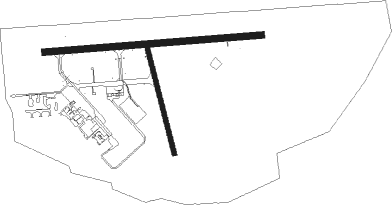
Prince Albert - Prince Albert (glass Field)
Airport details
| Country | Canada |
| State | Saskatchewan |
| Region | CY |
| Airspace | Winnipeg Ctr |
| Municipality | Prince Albert |
| Elevation | 1403ft (428m) |
| Timezone | GMT -6 |
| Coordinates | 53.21458, -105.67298 |
| Magnetic var | |
| Type | land |
| Available since | X-Plane v10.40 |
| ICAO code | CYPA |
| IATA code | YPA |
| FAA code | n/a |
Communication
| Prince Albert (Glass Field) Radio (Mandatory Frequency) | 122.300 |
Approach frequencies
| ILS-cat-I | RW08 | 110.3 | 18.00mi |
| 3° GS | RW08 | 110.3 | 18.00mi |

Nearby beacons
| code | identifier | dist | bearing | frequency |
|---|---|---|---|---|
| YPA | PRINCE ALBERT VOR/DME | 0.2 | 74° | 113 |
| PA | PRINCE ALBERT NDB | 4.4 | 272° | 347 |
| ZPA | GLASS (PRINCE ALBERT) NDB | 4.6 | 89° | 372 |
Departure and arrival routes
| Transition altitude | 18000ft |
| Transition level | 18000ft |
| SID end points | distance | outbound heading | |
|---|---|---|---|
| RW08 | |||
| DEDID2 | 25mi | 40° | |
| VEPRI1 | 25mi | 201° | |
| RW26 | |||
| ALOKA1 | 25mi | 243° | |
| MEMGI2 | 25mi | 341° | |
| STAR starting points | distance | inbound heading | |
|---|---|---|---|
| RW08 | |||
| KAVET1 | 14.7 | 45° | |
| PEKTO1 | 15.1 | 193° | |
| RW26 | |||
| KAVET1 | 14.7 | 45° | |
| PEKTO1 | 15.1 | 193° | |
Instrument approach procedures
| runway | airway (heading) | route (dist, bearing) |
|---|---|---|
| RW08 | REVIX (76°) | REVIX BRYTE (5mi, 360°) 3000ft |
| RW08 | SATOP (106°) | SATOP BRYTE (5mi, 180°) 3000ft |
| RNAV | BRYTE 3000ft BOPUG (6mi, 90°) 3000ft UBTIP (3mi, 90°) 2030ft CYPA (2mi, 93°) 1455ft IMEVI (2mi, 85°) PUSOK (3mi, 90°) 3400ft PUSOK (turn) | |
| RW26 | APDET (284°) | APDET EBNAM (5mi, 0°) 3100ft |
| RW26 | IKLIB (255°) | IKLIB EBNAM (5mi, 180°) 3100ft |
| RNAV | EBNAM 3100ft DERSA (6mi, 270°) 3100ft CYPA (5mi, 269°) 1456ft UMIDU (2mi, 275°) UDNAX (4mi, 270°) 3000ft UDNAX (turn) |
Disclaimer
The information on this website is not for real aviation. Use this data with the X-Plane flight simulator only! Data taken with kind consent from X-Plane 12 source code and data files. Content is subject to change without notice.