Peterborough
Airport details
| Country | Canada |
| State | Ontario |
| Region | CY |
| Airspace | Toronto Ctr |
| Municipality | Cavan-Monaghan |
| Elevation | 625ft (190m) |
| Timezone | GMT -5 |
| Coordinates | 44.23054, -78.36320 |
| Magnetic var | |
| Type | land |
| Available since | X-Plane v10.40 |
| ICAO code | CYPQ |
| IATA code | YPQ |
| FAA code | YPQ |
Communication
| Peterborough AWOS | 126.925 |
| Peterborough CTAF/UNICOM | 123.000 |
| Peterborough TORONTO Centre | 134.250 |
Nearby Points of Interest:
George Manning Furby House
-Victoria Hall
-Cream of Barley Mill
-Havelock railway station
-Petroglyphs Provincial Park
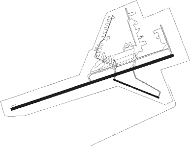
Runway info
Runway 09 / 27  | ||
| length | 2128m (6982ft) | |
| bearing | 80° / 260° | |
| width | 31m (100ft) | |
| surface | asphalt | |
| Runway 13 / 31 | ||
| length | 609m (1998ft) | |
| bearing | 110° / 290° | |
| width | 15m (49ft) | |
| surface | asphalt | |
| displ threshold | 0m (0ft) / 61m (200ft) | |
Nearby beacons
| code | identifier | dist | bearing | frequency |
|---|---|---|---|---|
| YPQ | PETERBOROUGH NDB | 4.4 | 260° | 379 |
| YCF | DME | 28.9 | 81° | 113.50 |
| YO | DME-ILS | 29.3 | 239° | 111.35 |
| OO | OSHAWA NDB | 29.7 | 240° | 391 |
| VIE | COEHILL VOR/DME | 32.9 | 48° | 115.10 |
| ZZR | SEVERN (TRENTON) NDB | 33.4 | 104° | 317 |
| YSO | DME | 34.7 | 271° | 117.35 |
| UTR | TRENTON TACAN | 36.5 | 97° | 109.70 |
| YTR | TRENTON NDB | 41.3 | 92° | 215 |
| KZ | BUTTONVILLE NDB | 45.3 | 253° | 248 |
Instrument approach procedures
| runway | airway (heading) | route (dist, bearing) |
|---|---|---|
| RW09 | AVSAM (98°) | AVSAM NALTU (5mi, 161°) 2700ft |
| RW09 | SATIK (59°) | SATIK NALTU (5mi, 341°) 2700ft |
| RNAV | NALTU 2700ft GABID (5mi, 80°) 2200ft DAXUL (3mi, 80°) 1310ft CYPQ (3mi, 80°) 675ft (4906mi, 119°) 2900ft AVSAM (4918mi, 299°) AVSAM (turn) | |
| RW27 | DASRO (260°) | DASRO URLIM (5mi, 260°) 2200ft |
| RW27 | EXTRO (240°) | EXTRO URLIM (5mi, 161°) 2200ft |
| RW27 | IGSOG (278°) | IGSOG URLIM (5mi, 341°) 2200ft |
| RNAV | URLIM 2200ft VIXAG (6mi, 260°) 2000ft CYPQ (5mi, 260°) 675ft ETMUD (4mi, 260°) 2900ft ETMUD (turn) |
Disclaimer
The information on this website is not for real aviation. Use this data with the X-Plane flight simulator only! Data taken with kind consent from X-Plane 12 source code and data files. Content is subject to change without notice.