Pelee Island
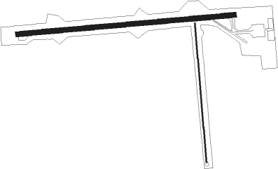
Airport details
| Country | Canada |
| State | Ontario |
| Region | CY |
| Airspace | Cleveland Ctr |
| Municipality | Pelee Township |
| Elevation | 570ft (174m) |
| Timezone | GMT -5 |
| Coordinates | 41.77762, -82.67802 |
| Magnetic var | |
| Type | land |
| Available since | X-Plane v10.40 |
| ICAO code | CYPT |
| IATA code | n/a |
| FAA code | n/a |
Communication
| Pelee Island CTAF/UNICOM | 123.200 |
Nearby Points of Interest:
Perry's memorial lighthouse
-Glacial Grooves State Memorial
-First Congregational Church
-Johnson's Island
-Feick Building
-Odd Fellows Hall
-Adams Street Double House
-Eleutheros Cooke House
-Engine House No. 1
-Erie County Jail
-Carnegie Library
-Engine House No. 3
-John Mertz House
-St. Mary's Rectory
-John Stang House
-St. Stephen's AME Church
-No. 5 Fire Station
-Taylor-Frohman House
-Erie County Infirmary
-Masonic Temple Building
-First Baptist Church
-Abbott-Page House
-Franks Site
-Amherstburg First Baptist Church

Nearby beacons
| code | identifier | dist | bearing | frequency |
|---|---|---|---|---|
| PCW | PORT CLINTON NDB | 17.7 | 216° | 423 |
| RYS | GROSSE ILE (DETROIT) NDB | 28.7 | 304° | 419 |
| QG | WINDSOR NDB | 33.2 | 340° | 353 |
| DJB | DRYER VOR/DME | 34.2 | 129° | 113.60 |
| DM | SPENC (DETROIT) NDB | 35.4 | 310° | 223 |
| CRL | CARLETON VOR/DME | 38.4 | 289° | 115.70 |
| DT | REVUP (DETROIT) NDB | 39.4 | 294° | 388 |
| DXO | DETROIT VOR/DME | 40.3 | 302° | 113.40 |
| TII | TIFFIN NDB | 47.6 | 218° | 269 |
| MTC | SELFRIDGE (MOUNT CLEMENS) TACAN | 50.6 | 350° | 133.70 |
| MFD | MANSFIELD VORTAC | 54.7 | 175° | 108.80 |
| SVM | SALEM VORTAC | 55.6 | 305° | 114.30 |
| PSI | DME | 67.2 | 317° | 111 |
Instrument approach procedures
| runway | airway (heading) | route (dist, bearing) |
|---|---|---|
| RW10 | DERDU (112°) | DERDU NUBET (5mi, 179°) 1900ft |
| RNAV | NUBET 1900ft ALUXA (5mi, 90°) 1900ft CYPT (4mi, 91°) 621ft VEPSA (5mi, 88°) 2100ft VEPSA (turn) | |
| RW28 | IRKEN (289°) | IRKEN PIXUV (5mi, 360°) 1900ft |
| RNAV | PIXUV 1900ft DUSAB (6mi, 270°) 1900ft MUPTA (2mi, 270°) 1200ft CYPT (2mi, 266°) 622ft (5078mi, 117°) 1100ft PIXUV (5067mi, 297°) 2100ft PIXUV (turn) |
Disclaimer
The information on this website is not for real aviation. Use this data with the X-Plane flight simulator only! Data taken with kind consent from X-Plane 12 source code and data files. Content is subject to change without notice.